Overview
The article titled "10 Benefits of GIS Software for Land Service Companies" highlights the significant advantages that Geographic Information Systems (GIS) software offers to land service companies. These benefits encompass:
- Enhanced data management
- Informed decision-making
- Cost savings
- Improved collaboration
- Increased operational efficiency
Collectively, these advantages empower organizations to optimize their workflows and respond more effectively to market demands.
The content elaborates on how GIS technology automates data processes, enhances spatial analysis capabilities, and facilitates real-time collaboration among teams. Consequently, this leads to more strategic and sustainable resource management practices, reinforcing the value of adopting GIS solutions in the land service sector.
Introduction
GIS software is revolutionizing the landscape of land service companies, presenting a wealth of advantages that streamline operations and enhance decision-making. By harnessing the power of geographic information systems, these companies can significantly improve data management, reduce costs, and foster collaboration among teams. However, as the industry evolves, organizations must consider how to effectively leverage GIS tools—not only to remain competitive but also to drive sustainability and efficiency. This article delves into ten compelling benefits of GIS software, revealing how it transforms land management practices and empowers businesses to meet the challenges of a rapidly changing market.
Parse AI: Streamline Title Research with Advanced Machine Learning
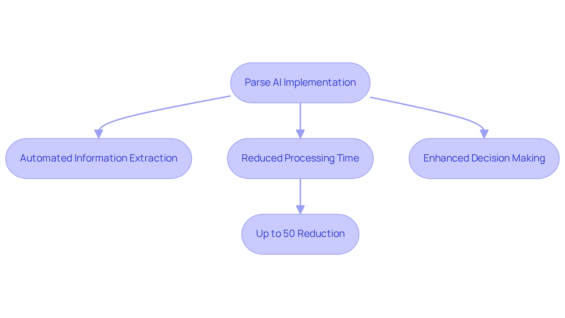
Parse AI leverages advanced machine learning algorithms to automate the extraction of crucial information from title documents. This innovative technology significantly reduces the time needed for , enabling land service companies to efficiently manage extensive data sets with GIS software for land service companies. By minimizing manual input, Parse AI enhances the reliability of title searches, empowering real estate professionals to make informed decisions based on precise information.
As one industry expert noted, "Machine learning (ML) has revolutionized how humans interact with information, technologies, and machines," highlighting the transformative impact of automation in title searches. Furthermore, businesses are reporting substantial reductions in processing times—often by as much as 50%—allowing firms to better meet the demands of a rapidly evolving real estate market.
The global machine learning market is anticipated to expand from USD 79.29 billion in 2024 to USD 503.40 billion by 2030, underscoring the significance of these advancements across various industries, including real estate.
Enhanced Data Management: Improve Efficiency with GIS Software
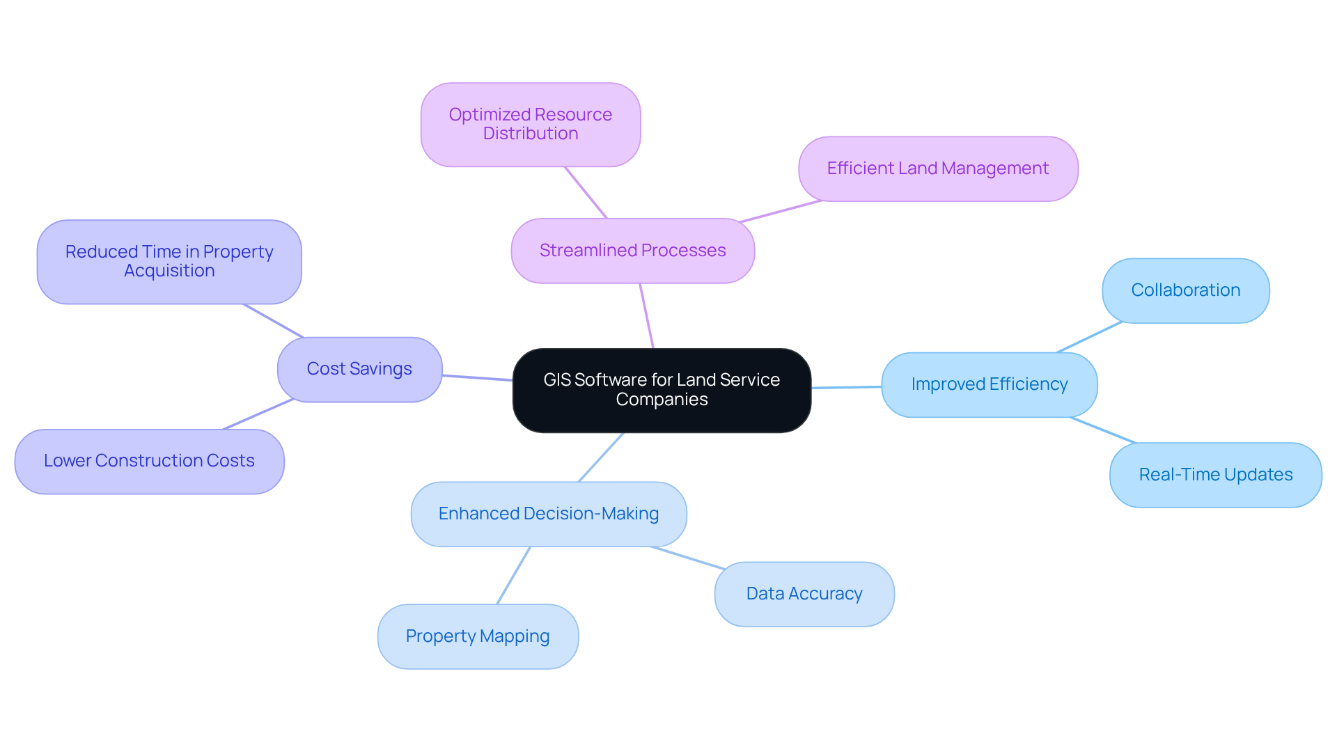
The GIS software for land service companies serves as a powerful tool, equipping them with robust capabilities to manage spatial information effectively. This technology allows for the of critical data. By integrating GIS software for land service companies into their operations, companies can enhance the precision and accessibility of information, which is vital for informed decision-making. Furthermore, the incorporation of GIS software for land service companies facilitates real-time updates and fosters seamless collaboration among team members, thereby driving efficiency across workflows.
For instance, GIS mapping has proven instrumental in negotiations by providing a comprehensive understanding of property ownership and environmental constraints. This insight significantly reduces the time and costs associated with property acquisition. In addition, the use of GIS software for land service companies can lower construction expenses for telecom operators by generating highly accurate maps that improve asset location. Consequently, organizations that leverage GIS can achieve substantial cost savings while simultaneously enhancing the accuracy of their information management processes.
Informed Decision-Making: Leverage GIS for Strategic Insights
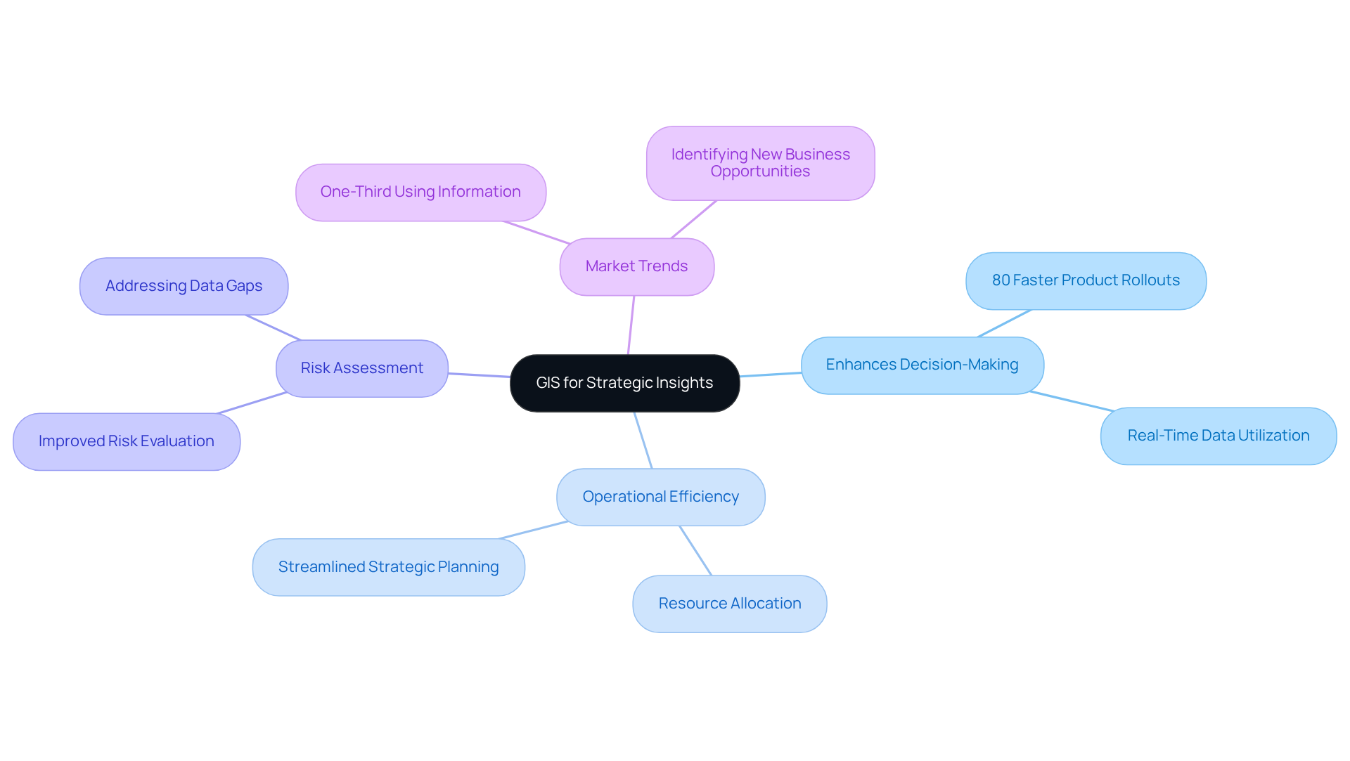
GIS technology significantly enhances the ability of service providers to make informed, data-driven choices through comprehensive spatial analysis. By visualizing geographic information, organizations can uncover trends, assess risks, and evaluate various land use scenarios. This capability not only streamlines but also enables businesses to allocate resources more effectively and respond proactively to evolving market conditions.
Notably, over 80% of companies have achieved faster product rollouts through the utilization of real-time information. It is imperative for land service firms to leverage GIS software for land service companies to enhance their operational efficiency. Furthermore, integrating GIS into decision-making processes facilitates better risk assessment, addressing the primary obstacle to data-driven decisions: the lack of essential information.
As highlighted by Purple Land Management, "GIS mapping is the process of creating visual representations of geographic information using Geographic Information Systems," underscoring the importance of spatial analysis in aligning strategic decisions with organizational goals and market demands. Moreover, with only one-third of companies currently using information to identify new business opportunities, the role of GIS software for land service companies in optimizing information utilization for strategic insights becomes increasingly vital.
Cost Savings: Reduce Operational Expenses with GIS Solutions
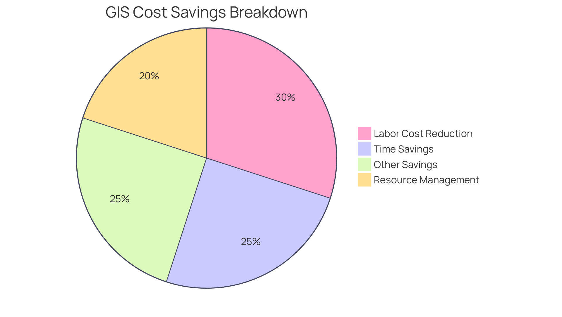
Implementing GIS software for land service companies can yield substantial cost savings for land service providers. By automating data collection and analysis, GIS significantly diminishes the reliance on extensive manual labor, leading to a marked reduction in operational expenses. For example, GIS can decrease redundancy in network modeling efforts by as much as 30%.
Organizations that have embraced GIS technology have reported not only but also considerable time savings. Furthermore, GIS enhances resource management, allowing organizations to avoid unnecessary expenditures and streamline workflows effectively.
It is crucial to acknowledge that the initial investment for setup and training can be considerable. Nevertheless, the long-term financial benefits of adopting GIS software for land service companies are profound, positioning it as a strategic investment for service professionals aiming for efficiency and cost-effectiveness.
Sustainability: Promote Eco-Friendly Practices with GIS Tools
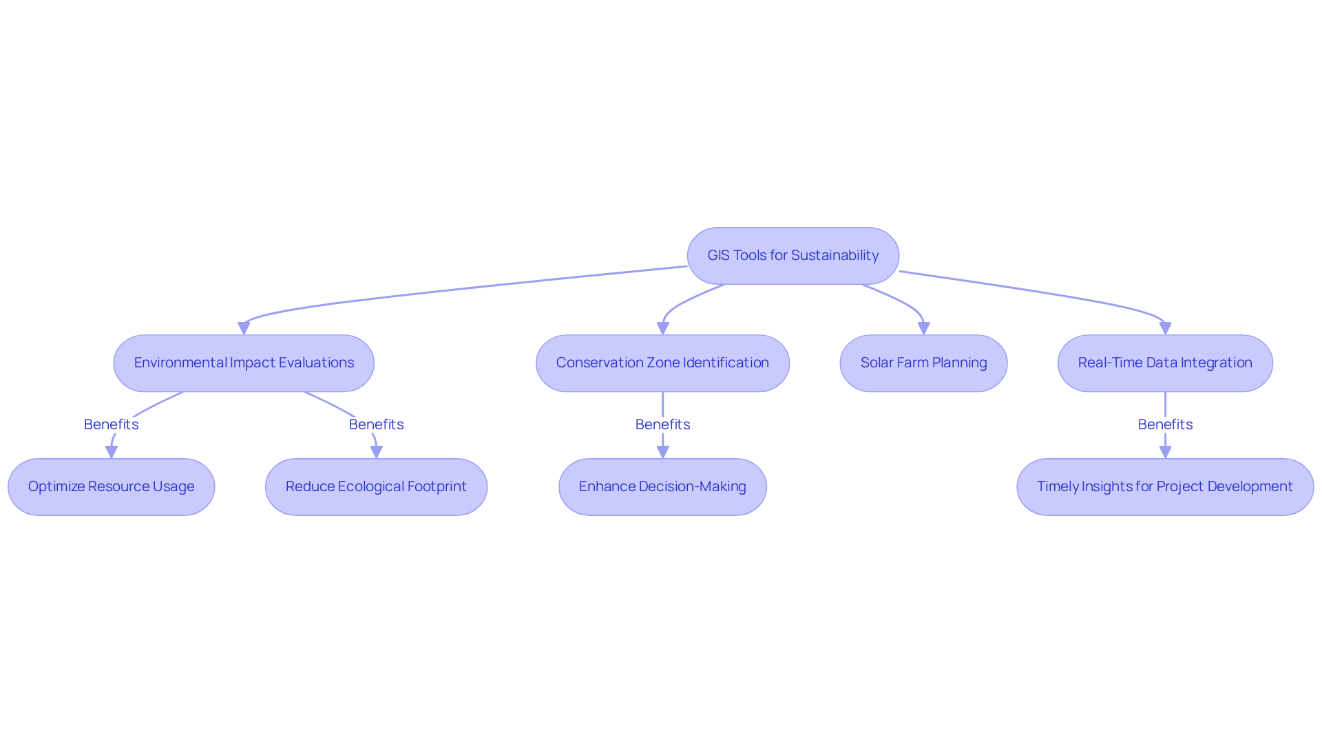
GIS tools play a pivotal role in advancing sustainability within resource service organizations by facilitating comprehensive environmental impact evaluations. By analyzing spatial information related to natural resources, these organizations can pinpoint conservation zones, optimize resource usage, and significantly reduce their ecological footprints.
For instance, GIS enables the integration of sustainability objectives into resource management practices, ensuring that development initiatives are aligned with environmental conservation efforts. Notably, GIS mapping has proven essential in solar farm planning, identifying regions with high solar radiation and suitable terrain, thus optimizing site selection for renewable energy projects.
As Syed Atif Bokhari aptly stated, "the effective utilization of economical remotely gathered information provides a practical and dependable instrument for assessing, evaluating, and monitoring urban resource management." This technology not only enhances decision-making but also bolsters the implementation of , ultimately contributing to a more sustainable future.
Furthermore, the integration of real-time information gathering through IoT and drones into GIS mapping systems allows for timely insights that can further assist in mitigating environmental impacts during project development.
Risk Management: Enhance Safety and Compliance with GIS
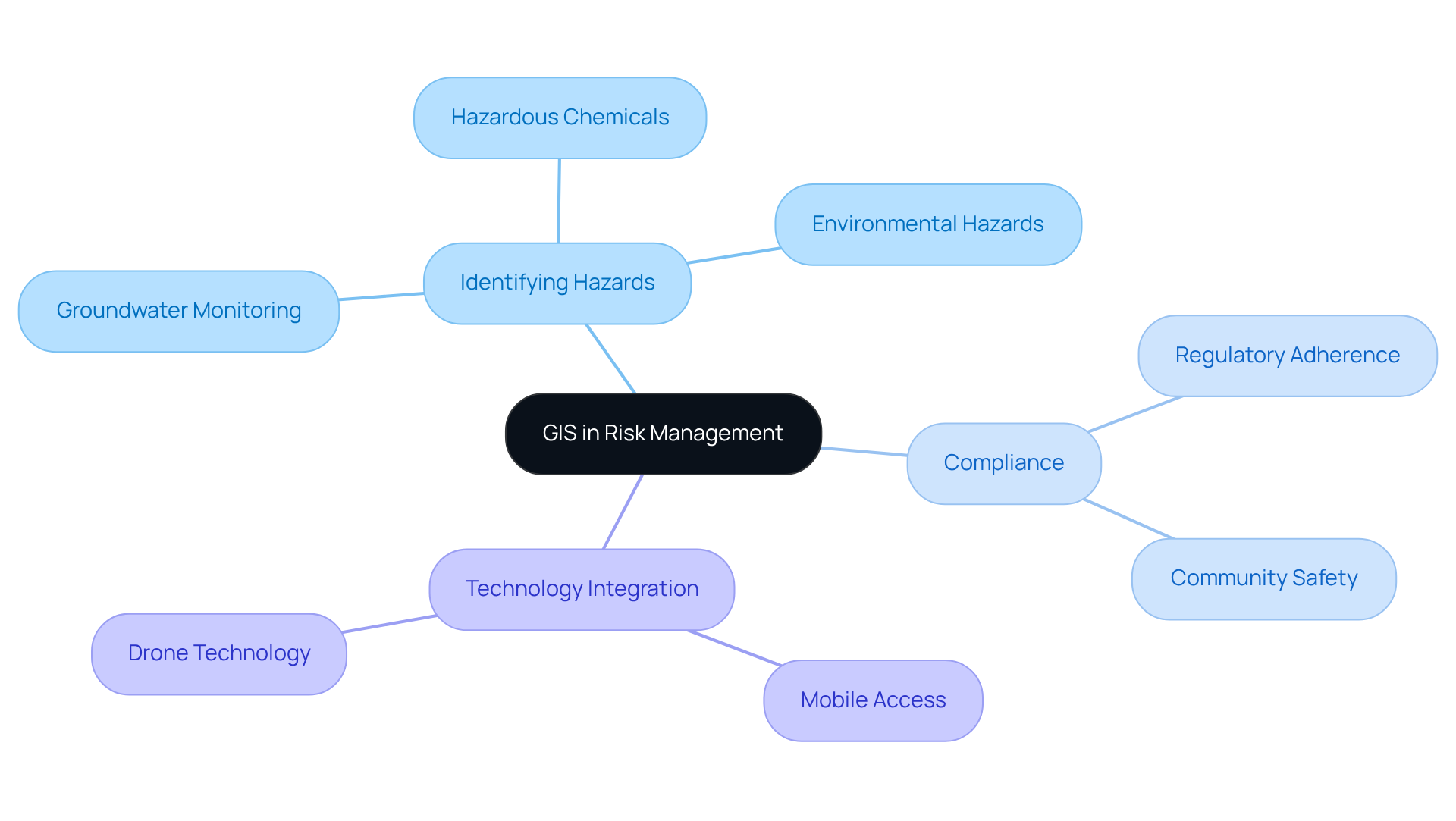
GIS technology, particularly GIS software for land service companies, significantly enhances risk management by equipping these companies with effective tools to identify and analyze potential hazards in usage planning. By visualizing critical information related to environmental risks—such as flood zones, hazardous materials, and other safety concerns—companies can devise effective strategies to mitigate these risks. Furthermore, the use of GIS software for land service companies plays a vital role in ensuring compliance with regulatory requirements, as it provides precise and comprehensive information that informs land use decisions. For instance, GIS can assist in:
- Plotting groundwater monitoring wells
- Tracking hazardous chemical locations
- Visualizing environmental hazards
This facilitates adherence to safety regulations and improves overall community safety.
The integration of from mobile devices enhances inspections and incident reporting, allowing for prompt responses to potential threats. Additionally, tools like the EPA's EJScreen combine environmental and demographic information to advance environmental justice, further strengthening compliance efforts. The incorporation of drone technology with GIS enables more effective information gathering and analysis, presenting a modern approach to risk management. As Panagiotis Giannakis articulates, 'Only an individual with GIS expertise can connect these information sets and their implications to the physical world,' emphasizing the vital importance of GIS software for land service companies in enhancing safety and compliance in spatial planning.
Real-World Applications: Utilize GIS for Diverse Land Management Needs
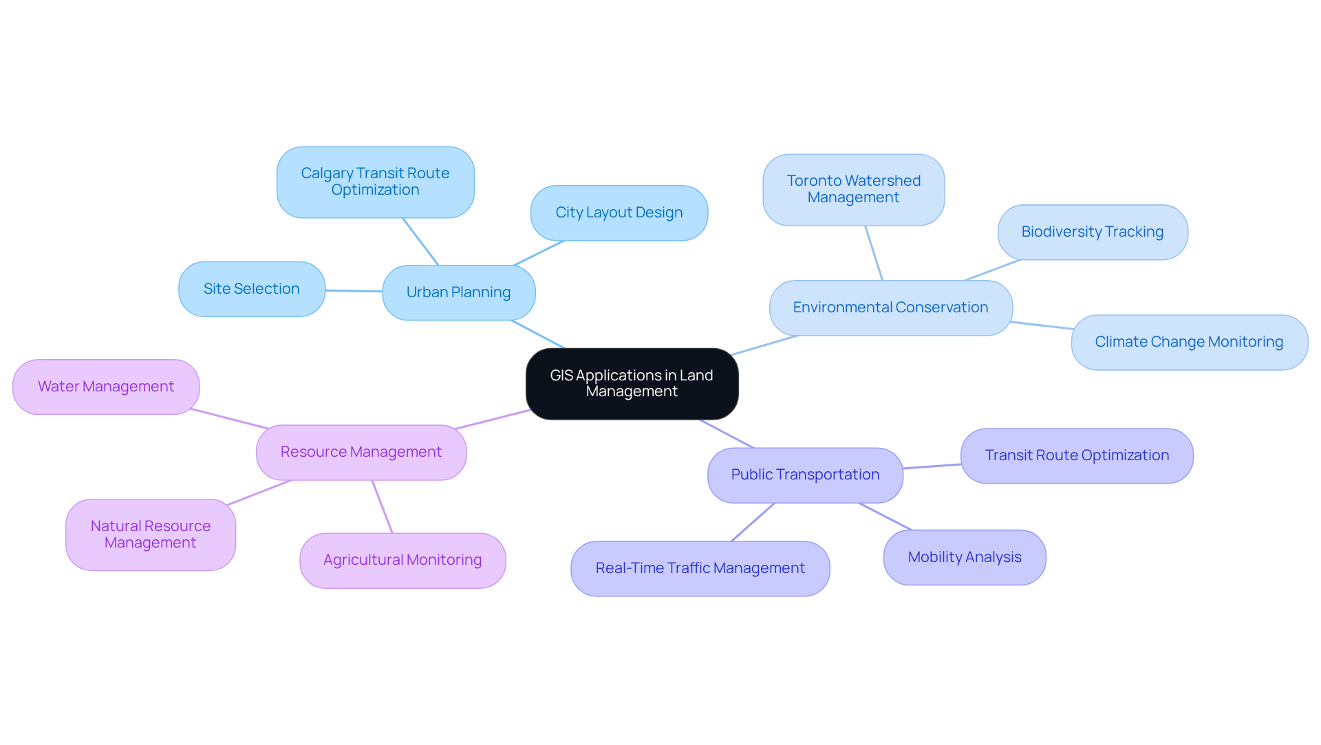
GIS serves as a powerful instrument for diverse management applications, particularly in urban planning and environmental conservation. It facilitates site selection for new developments, allowing planners to evaluate optimal locations based on criteria such as zoning laws and environmental impact.
For example, the City of Calgary utilized GIS and GTFS information to analyze mobility and operational features, thereby enhancing transit routes for maximum ridership. This initiative resulted in improved and increased user satisfaction.
Furthermore, GIS plays a critical role in monitoring usage patterns and changes in coverage over time, providing essential insights for sustainable development. The Toronto and Region Conservation Authority employs an integrated GIS platform equipped with real-time sensors and mobile information gathering to manage watersheds, thereby enhancing environmental evaluations and flood risk reporting.
By leveraging GIS software for land service companies, service providers can significantly improve their operational efficiency and responsiveness to emerging challenges, ultimately fostering more sustainable resource management practices.
Collaboration: Foster Teamwork and Communication with GIS Platforms
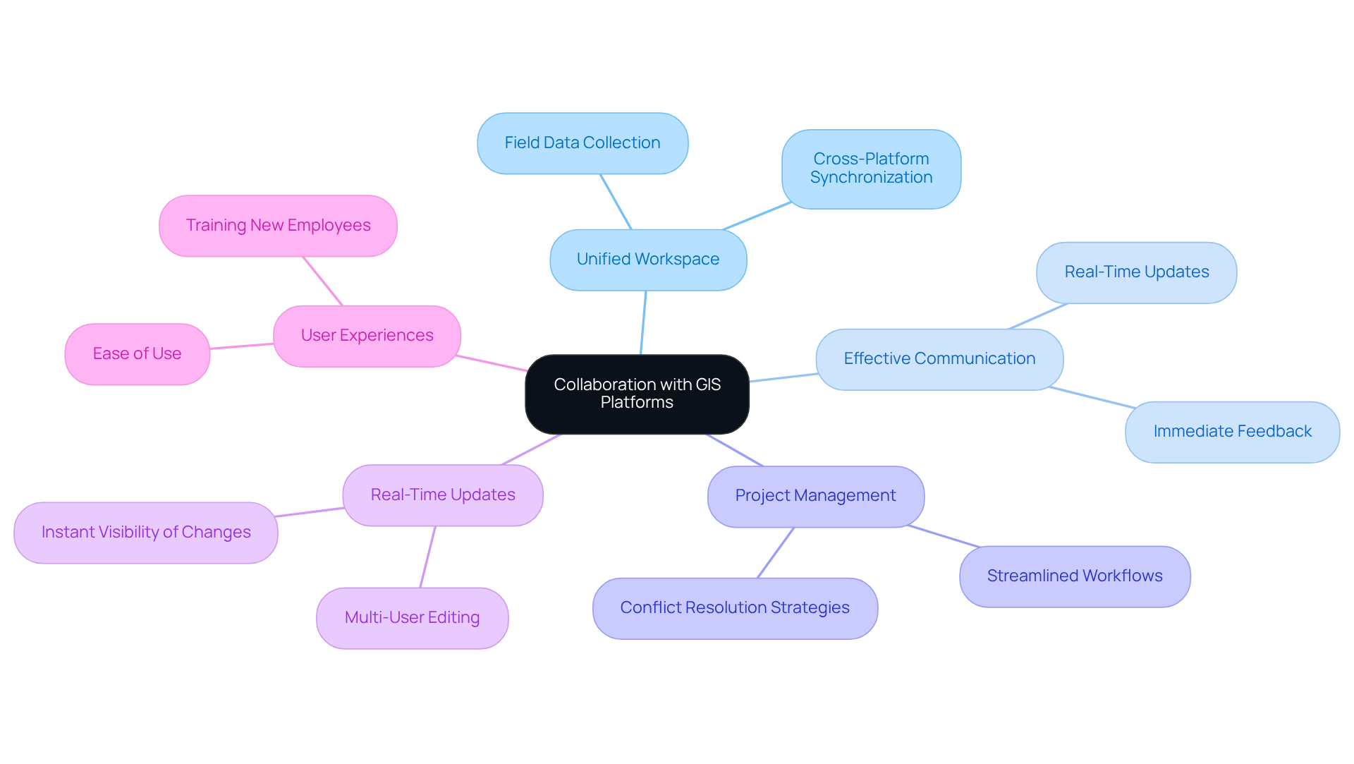
GIS platforms significantly enhance collaboration by creating a unified workspace where team members can collectively access and analyze spatial information. This shared environment fosters effective communication among stakeholders, facilitating real-time updates and immediate feedback. By leveraging GIS for collaboration, service organizations can refine project management procedures, minimize misunderstandings, and ensure that all participants are aligned with project goals.
For example, environmental monitoring teams can promptly share field data, enabling swift responses to emerging issues. Meanwhile, urban planning teams can update infrastructure maps in real time, thereby enhancing overall project efficiency. The integration of GIS software for land service companies not only streamlines operational workflows but also fosters a culture of collaboration, ultimately resulting in improved decision-making and project outcomes.
Notably, nearly 80% of workers had adopted collaboration tools by 2021, highlighting the growing significance of GIS in enhancing teamwork. Furthermore, real-time multi-user editing capabilities allow multiple team members to work on maps simultaneously, further bolstering collaboration.
As Albert Wang, an engineering co-op student at Westmoreland Mining LLC, remarked, "WingtraOne’s user-friendly workflow really helps out, especially if we have new students or employees." This underscores the for land service companies in enhancing collaboration and communication within service organizations.
Technological Advancements: Stay Competitive with Cutting-Edge GIS Tools
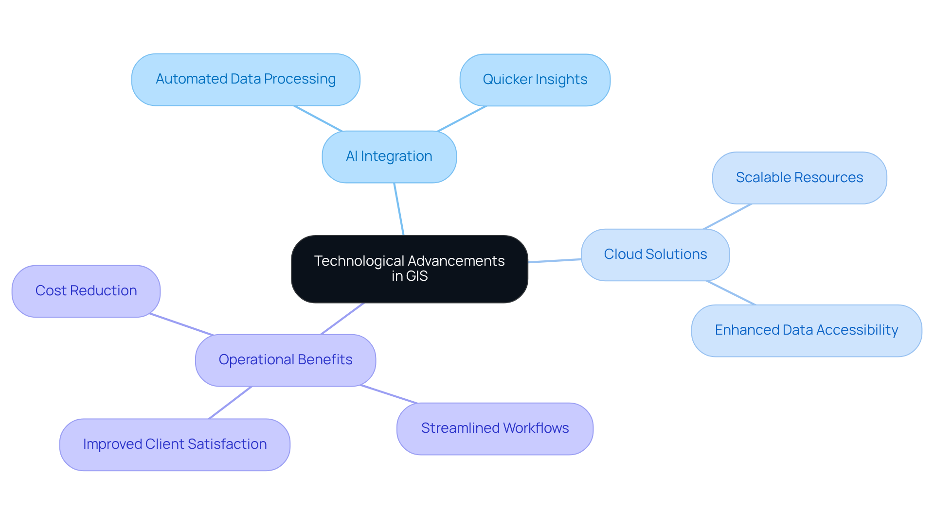
To maintain a competitive edge, land service companies must embrace for land service companies that significantly enhances their operational capabilities. Recent technological advancements, particularly the integration of artificial intelligence and cloud-based solutions, create new opportunities for analysis and visualization. For instance, AI-driven GIS applications can automate data processing, enabling quicker insights and more informed decision-making. Companies leveraging these innovations can streamline workflows, reduce costs, and improve service delivery to clients.
The importance of adopting cutting-edge GIS software for land service companies cannot be overstated. These tools empower organizations to respond swiftly to market demands and optimize their resource management. As the landscape of service solutions evolves, it is crucial to stay abreast of the latest innovations in GIS software for land service companies. This commitment not only promotes operational efficiency but also enhances client satisfaction.
Comprehensive Benefits: Transform Land Management with GIS Software
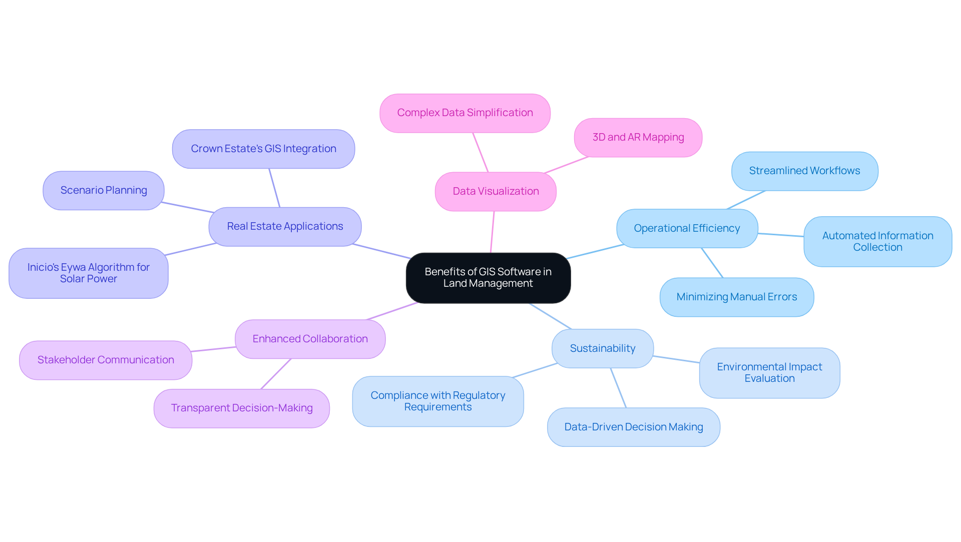
GIS software presents a formidable array of advantages that can significantly transform resource management practices. By enhancing information management and facilitating informed decision-making, GIS software for land service companies empowers them to optimize their operations. For instance, GIS technologies are instrumental in minimizing conflicts and offering alternative routing options for right-of-way acquisition, a critical factor for streamlining workflows. This capability enables organizations to and discern patterns that inform strategic planning, ultimately leading to cost reductions and improved collaboration among stakeholders.
The influence of GIS on operational efficiency is particularly pronounced in the realm of real estate. Businesses that leverage GIS can refine their workflows by automating information collection and analysis, thereby diminishing manual errors and accelerating project timelines. A prime example is the Crown Estate's GIS software, which integrates information from over 250 sources for scenario planning, illustrating how GIS enhances the accuracy of strategic planning and decision-making.
Moreover, GIS plays a pivotal role in supporting sustainability initiatives by allowing organizations to evaluate environmental impacts and make data-driven decisions that comply with regulatory requirements. As underscored by Purple Land Management, spatial analysis tools embedded within GIS mapping software provide robust capabilities for in-depth examination of geospatial data, thereby facilitating superior decision-making. Furthermore, the application of Inicio's Eywa algorithm for solar power site selection exemplifies GIS's practical utility in real estate, demonstrating its ability to streamline site selection processes while honoring local agricultural activities. The adoption of GIS software for land service companies is vital for modernizing land management practices, ensuring that companies remain competitive and responsive to the evolving demands of the market.
Conclusion
The integration of GIS software into land service companies signifies a transformative leap in operational efficiency and strategic decision-making. This technology streamlines data management and empowers organizations to make informed choices that align with market demands and sustainability goals. By leveraging GIS, companies enhance collaboration, reduce costs, and improve risk management, ultimately positioning themselves for success in a competitive landscape.
Key benefits of GIS software include:
- Enhanced data management capabilities
- Informed decision-making through spatial analysis
- Significant cost savings
- Improved collaboration among teams
Furthermore, the role of GIS in promoting sustainability and ensuring compliance with regulatory requirements is vital for modern land management practices. The incorporation of advanced technologies, such as AI and machine learning, amplifies these benefits, paving the way for a more efficient and responsive approach to land service operations.
In conclusion, embracing GIS software is not merely an option; it is a necessity for land service companies aiming to thrive in an evolving industry. By adopting these innovative tools, organizations unlock new opportunities for growth, enhance operational capabilities, and contribute to a sustainable future. The time to invest in GIS technology is now, as it holds the key to transforming land management practices and ensuring long-term success.
Frequently Asked Questions
What is Parse AI and how does it benefit title research?
Parse AI is a technology that uses advanced machine learning algorithms to automate the extraction of crucial information from title documents. It significantly reduces the time needed for title research, enhances the reliability of title searches, and allows real estate professionals to make informed decisions based on precise information.
How much can processing times be reduced by using Parse AI?
Businesses using Parse AI report substantial reductions in processing times—often by as much as 50%.
What is the significance of the global machine learning market in relation to real estate?
The global machine learning market is expected to grow from USD 79.29 billion in 2024 to USD 503.40 billion by 2030, highlighting the importance of machine learning advancements across various industries, including real estate.
What capabilities does GIS software provide for land service companies?
GIS software equips land service companies with the ability to manage spatial information effectively, allowing for systematic arrangement, analysis, and visualization of critical data. It enhances the precision and accessibility of information, facilitates real-time updates, and fosters seamless collaboration among team members.
How does GIS mapping aid in negotiations and property acquisition?
GIS mapping provides a comprehensive understanding of property ownership and environmental constraints, significantly reducing the time and costs associated with property acquisition.
What cost savings can GIS software offer telecom operators?
The use of GIS software can lower construction expenses for telecom operators by generating highly accurate maps that improve asset location, leading to substantial cost savings.
How does GIS technology enhance informed decision-making?
GIS technology enhances decision-making by enabling comprehensive spatial analysis, allowing organizations to visualize geographic information, uncover trends, assess risks, and evaluate various land use scenarios.
What impact does real-time information have on product rollouts?
Over 80% of companies utilizing real-time information have achieved faster product rollouts, emphasizing the importance of integrating GIS software into operational processes.
What is the current usage of information for identifying new business opportunities among companies?
Currently, only one-third of companies are using information to identify new business opportunities, highlighting the need for better utilization of GIS software for strategic insights.


