Overview
Land records significantly enhance zoning analysis for title researchers by providing essential information on property ownership, boundaries, and zoning classifications. This information is crucial for navigating local land-use regulations. Furthermore, a thorough examination of these records can uncover historical property uses and current zoning designations. Consequently, this enables researchers to make informed recommendations regarding potential redevelopment opportunities and compliance with evolving regulations.
Introduction
Understanding the intricate relationship between land records and zoning analysis is crucial for title researchers navigating the complexities of property transactions. These official documents delineate ownership and boundaries, holding the key to unlocking insights about land-use regulations and potential development opportunities. However, as zoning laws evolve and become increasingly complex, title researchers must effectively leverage these records to inform their analyses and recommendations. This article delves into the essential role of land records in zoning analysis, exploring the tools and strategies that empower researchers to overcome challenges and enhance their decision-making processes.
Understand Land Records and Their Importance in Zoning Analysis
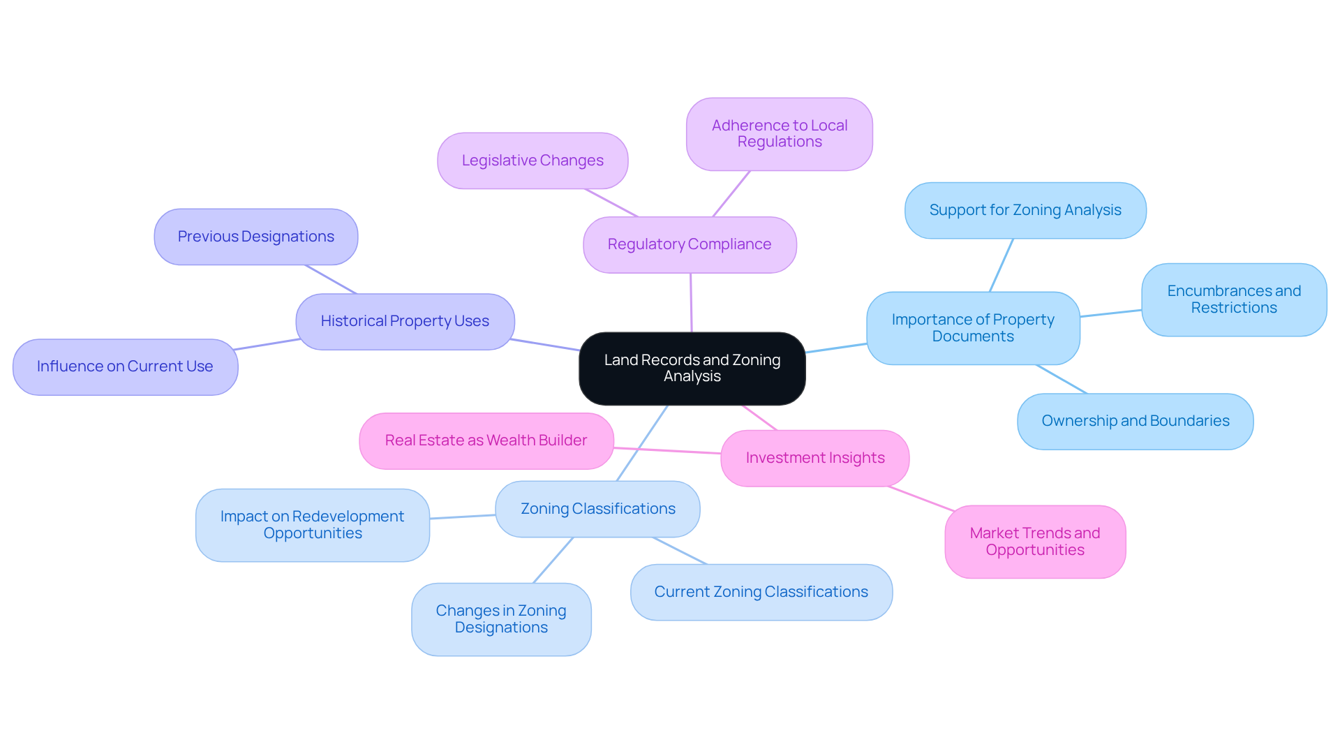
Property documents serve as essential official papers that delineate ownership, boundaries, and any encumbrances or restrictions related to the area. Their significance in land-use analysis is paramount, especially in understanding how land records support zoning analysis by providing title analysts with the critical insights needed to navigate local land-use regulations effectively. By meticulously examining these documents, scholars can uncover how land records support zoning analysis, as well as historical property uses, current zoning classifications, and any alterations that may influence future developments.
For instance, when a title researcher discovers that a property was previously designated for commercial use but is now classified for residential purposes, they can offer invaluable guidance to clients regarding potential redevelopment opportunities or associated risks. This proactive approach resonates with the wisdom of real estate professionals like Marshall Field, who asserted that . Additionally, as Louis Glickman aptly stated, 'The best investment on Earth is earth,' underscoring the fundamental role of property in investment decisions.
Moreover, recent advancements in property documentation and adherence to regulations underscore the necessity of remaining vigilant about legislative changes. As highlighted in case studies, such as the comprehensive revision of property development regulations in Charlottesville aimed at enhancing affordable housing, understanding property documents is crucial for ensuring compliance and making strategic investment choices. Notably, the housing deficit is projected to require over 16 million additional homes, emphasizing the importance of understanding property documents in relation to regulatory compliance and housing affordability.
In conclusion, understanding how land records support zoning analysis is vital for effective planning analysis, empowering title researchers to make informed recommendations that align with both current regulations and future market trends.

Identify Key Types of Land Records for Zoning Analysis
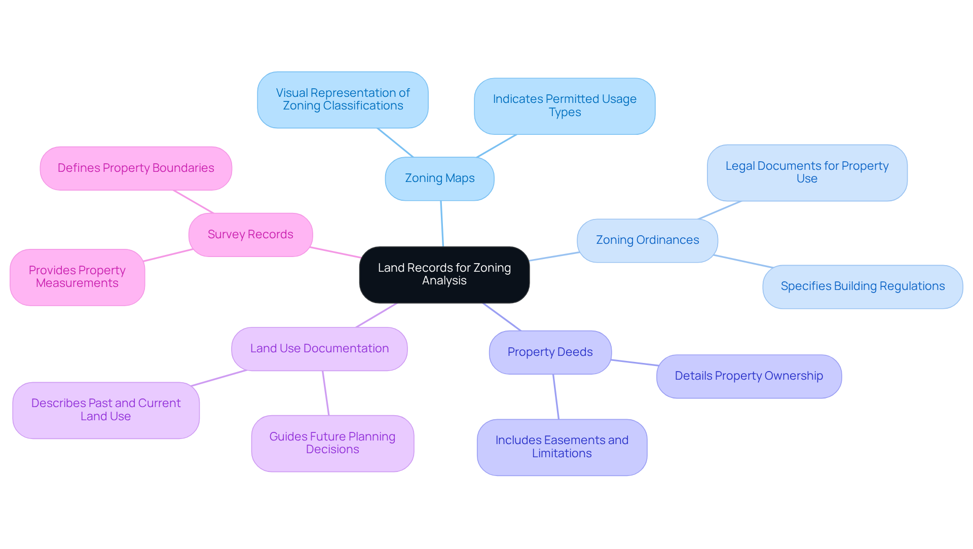
It is crucial to understand how land records support zoning analysis.
Zoning Maps serve as visual representations that illustrate the zoning classifications of various regions, indicating what types of usage are permitted.
are legal documents that specify the rules and regulations controlling the use of property within a jurisdiction, including restrictions on building heights, setbacks, and types of use.
Property Deeds provide details regarding property ownership and any easements or limitations that may influence the use of the property.
Furthermore, Land Use Documentation describes previous and existing applications of the land, which can guide future planning choices.
Lastly, Survey Records provide exact measurements and boundaries of properties, essential for comprehending land use compliance.
By becoming acquainted with these documents, title analysts can better evaluate how land records support zoning analysis for specific properties and recognize any possible concerns that may occur.

Access and Utilize Land Records Using Technology and Tools
To access and utilize land records effectively, title researchers can employ various technologies and tools.
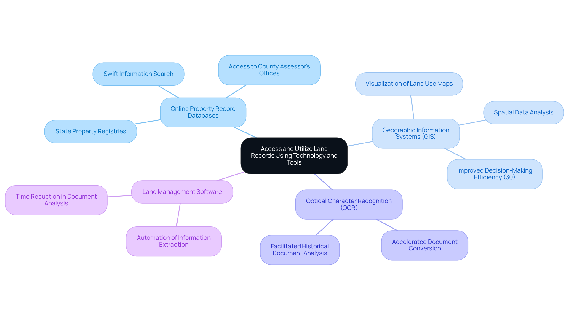
- Online Property Record Databases: Numerous jurisdictions provide online access to property records, enabling individuals to search for information swiftly. Websites such as or state property registries serve as excellent starting points.
- Geographic Information Systems (GIS): GIS technology empowers researchers to visualize land use maps and analyze spatial data related to land use. This capability assists in recognizing land use compliance and identifying potential development opportunities. In 2025, the incorporation of GIS in land use analysis demonstrated an improvement in decision-making efficiency by up to 30%, facilitating the identification of appropriate properties for development.
- Optical Character Recognition (OCR): By employing OCR technology, the process of converting paper documents into digital formats can be accelerated, thereby facilitating the search and analysis of historical property documents.
- Land Management Software: Tools such as Parse AI can automate the extraction of relevant information from extensive collections of title documents, significantly reducing the time required for analysis.
By integrating these technologies into their processes, title specialists can enhance their efficiency and precision in retrieving and utilizing land documentation, which illustrates how land records support zoning analysis.

Overcome Challenges in Zoning Analysis with Land Records
Zoning analysis presents several challenges; however, understanding how to navigate these obstacles can lead to more effective outcomes:
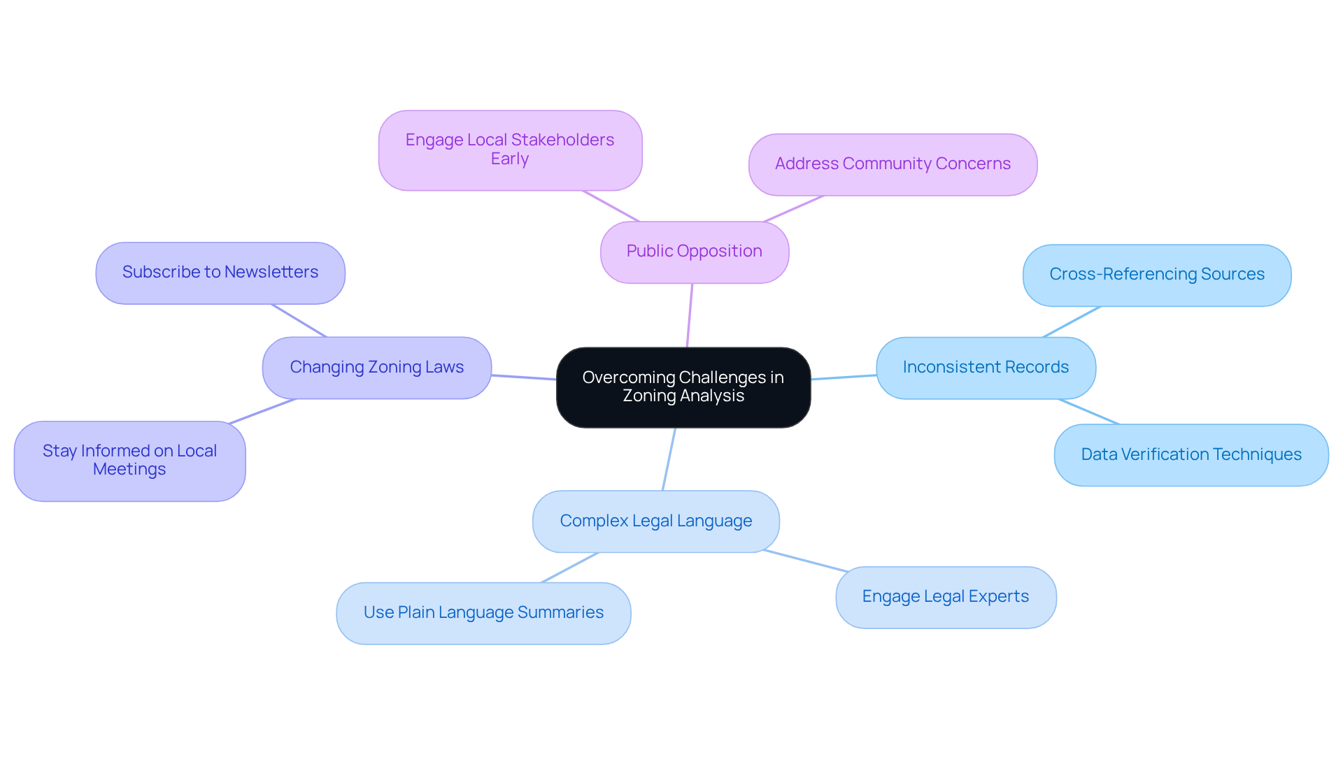
- Inconsistent Records: Land records may contain discrepancies or outdated information. Researchers must cross-reference multiple sources to verify data accuracy.
- Complex Legal Language: Zoning ordinances can be difficult to interpret. Engaging with legal experts or utilizing plain language summaries can clarify complex regulations.
- Changing Zoning Laws: Zoning regulations can change frequently. Staying informed about local planning board meetings and subscribing to is essential for remaining knowledgeable.
- Public Opposition: Community pushback can complicate land use approvals. Researchers should engage with local stakeholders early in the process to address concerns and foster collaboration.
By proactively addressing these challenges, title researchers can enhance their zoning analysis, particularly by understanding how land records support zoning analysis, leading to more informed decision-making in real estate transactions.

Conclusion
Understanding the intricate relationship between land records and zoning analysis is essential for title researchers navigating the complexities of property ownership and usage. By harnessing insights from these official documents, professionals can make informed decisions that align with current regulations and future development opportunities. This foundational knowledge not only aids in compliance but also empowers title researchers to guide clients effectively through the nuances of land-use regulations.
The article highlights several key aspects of how land records enhance zoning analysis. It discusses the importance of various types of land records, including:
- Zoning maps
- Ordinances
- Property deeds
- Survey records
Each plays a crucial role in understanding property classifications and potential uses. Furthermore, the integration of technology—such as online databases, GIS, and land management software—has revolutionized the accessibility and analysis of these records, streamlining the research process for title specialists. Additionally, overcoming challenges like inconsistent records and complex legal language is crucial for successful zoning analysis.
In light of the critical role that land records play in zoning analysis, it is imperative for title researchers to continually refine their skills and knowledge in this area. By embracing technological advancements and staying informed about regulatory changes, professionals can enhance their effectiveness in real estate transactions. Ultimately, a thorough understanding of land records not only contributes to individual success but also fosters more informed and sustainable property development practices that benefit communities as a whole.
Frequently Asked Questions
What are land records and why are they important in zoning analysis?
Land records are official documents that detail ownership, boundaries, and any encumbrances or restrictions related to a property. They are crucial in zoning analysis as they provide title analysts with insights necessary to navigate local land-use regulations effectively.
How do land records support zoning analysis?
By examining land records, scholars can uncover historical property uses, current zoning classifications, and changes that may affect future developments. This information helps in understanding the implications of zoning classifications on property investment and development opportunities.
What can a title researcher learn from land records regarding property classification changes?
A title researcher can discover if a property has changed from one classification to another, such as from commercial to residential. This knowledge allows them to advise clients on potential redevelopment opportunities or associated risks.
Why is it important to stay updated on legislative changes related to property documentation?
Staying informed about legislative changes is essential for ensuring compliance with current regulations and making strategic investment choices. Recent case studies, like those in Charlottesville, highlight the need for vigilance in property development regulations.
What is the significance of understanding property documents in relation to housing affordability?
Understanding property documents is vital for ensuring compliance with regulations that impact housing development. With a projected housing deficit requiring over 16 million additional homes, this understanding is crucial for addressing housing affordability challenges.
What role do land records play in strategic planning and investment decisions?
Land records empower title researchers to make informed recommendations that align with current regulations and future market trends, which is essential for effective planning analysis and sound investment decisions in real estate.


