Overview
Land grid systems with title overlays significantly enhance title research by providing structured frameworks that simplify the identification and verification of land parcels. This improvement not only boosts ownership tracking but also ensures compliance with legal standards. Furthermore, the article underscores that the integration of advanced technologies, such as Geographic Information Systems (GIS) and optical character recognition (OCR), streamlines workflows and reduces errors. Consequently, this leads to more efficient and accurate property transactions.
Introduction
Land grid systems, notably the Public Land Survey System (PLSS), play a pivotal role in title research, offering a structured approach to land ownership and zoning. By integrating title overlays, these systems empower property researchers to navigate complex ownership landscapes with heightened accuracy and efficiency.
As the real estate market becomes increasingly intricate, the question arises: how can researchers effectively leverage these tools to surmount common challenges and enhance their investigative processes?
This article explores the transformative potential of land grid systems and title overlays, providing insights and strategies to optimize title research practices.
Understand Land Grid Systems and Their Importance in Title Research
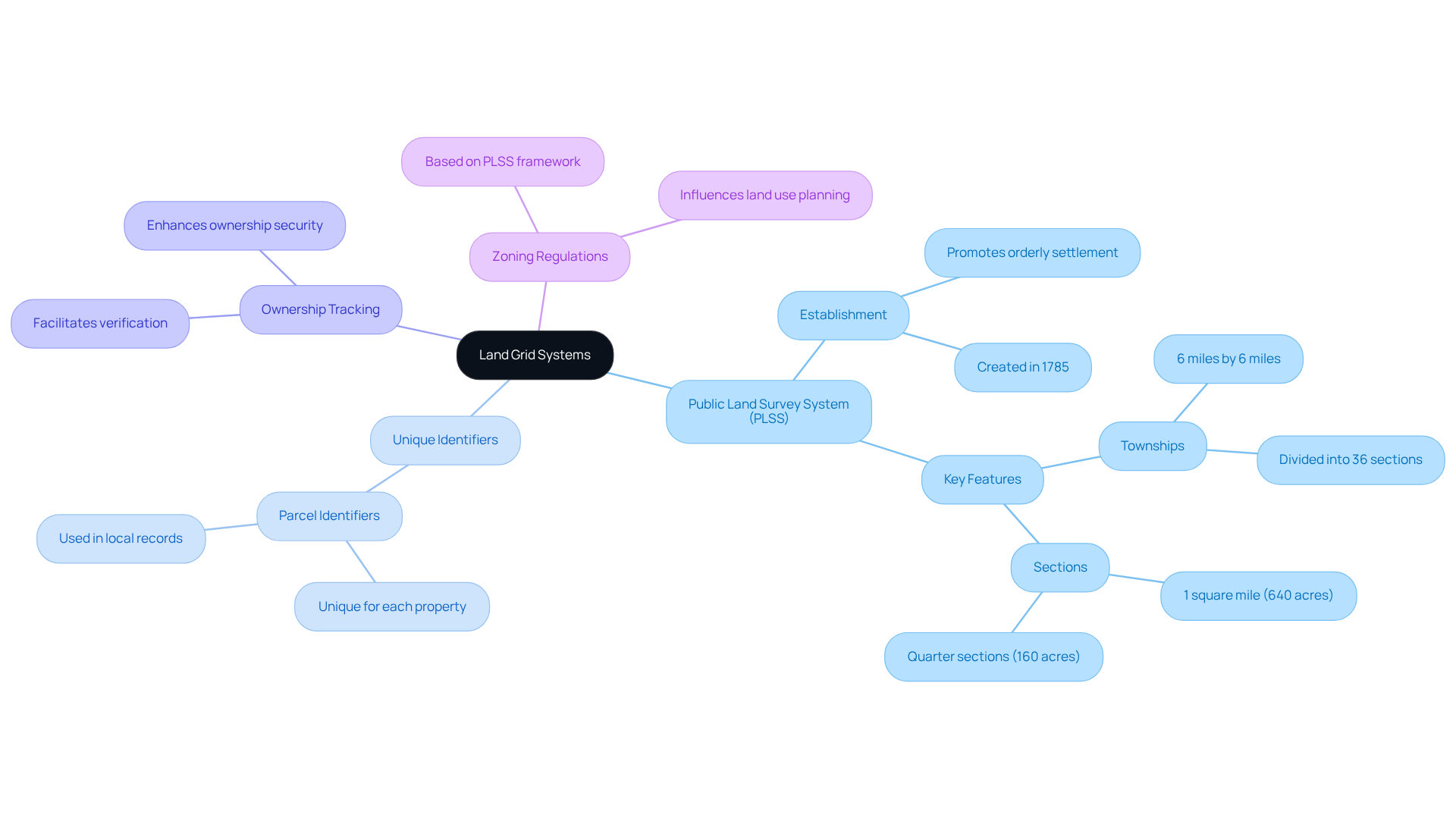
Land grid systems with title overlays, such as the Public Land Survey System (PLSS), provide structured frameworks that divide land into parcels based on specific measurements. Each parcel is assigned a unique identifier, which facilitates the tracking of ownership, access rights, and zoning regulations. Understanding these systems is essential for as they navigate complex ownership information.
For example, the PLSS utilizes land grid systems with title overlays, which simplify the identification of land parcels and make it easier to verify ownership and resolve disputes. Consequently, by utilizing these systems, property researchers can enhance their efficiency and precision in transactions, leading to more informed decision-making in real estate.

Implement Title Overlays to Improve Accuracy in Title Research
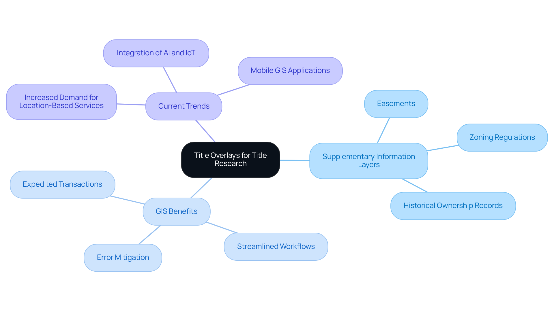
Land grid systems with title overlays incorporate the integration of supplementary information layers onto existing map displays, encompassing critical details such as easements, zoning regulations, and historical ownership records. Utilizing (GIS), researchers can visualize intricate relationships, significantly enhancing their ability to identify inconsistencies and ensure compliance with legal standards.
Anupama Chandran articulates GIS as a 'computer-based system utilized to gather, store, analyze, manipulate, and present geographical information,' underscoring its importance in research pertaining to property names. For example, GIS tools facilitate the seamless overlay of diverse data sets, offering a comprehensive view of property rights and restrictions.
This methodology not only mitigates the risk of errors in document searches but also streamlines workflows, resulting in expedited turnaround times for property transactions. Current trends indicate an increasing reliance on GIS tools in property investigations, driven by the escalating demand for location-based services and the integration of AI and IoT technologies, which enhance precision and efficiency in an increasingly complex real estate landscape.

Address Common Challenges in Title Research with Effective Strategies
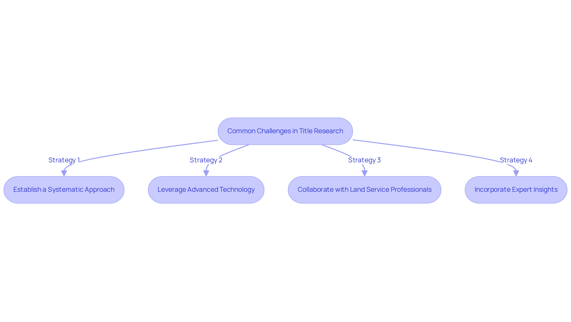
Title research frequently encounters obstacles such as incomplete records, discrepancies in ownership information, and challenges in interpreting legal language. To effectively navigate these issues, title researchers should implement several key strategies.
- Establish a Systematic Approach: A methodical approach to information gathering and verification is essential for capturing all relevant details accurately. As emphasized in external sources, careful sampling techniques are crucial for ensuring information reliability (Statistic 14495).
- Leverage Advanced Technology: Utilizing technology, including , assists in identifying potential discrepancies in ownership data. This proactive method enables scholars to tackle problems before they intensify, consequently improving the overall effectiveness of the investigation process.
- Collaborate with Land Service Professionals: Engaging with land service professionals provides valuable insights into common pitfalls and best practices. This partnership assists scholars in circumventing possible obstacles in the investigative process, ultimately resulting in more precise and effective outcomes.
- Incorporate Expert Insights: Utilizing expert guidance, such as Jacob Shreffler's perspectives on avoiding pitfalls in the investigation process, further enhances the strategies employed in naming studies. Shreffler emphasizes the importance of understanding what has been done and what remains undiscovered in the field, which can guide researchers in their efforts.
By implementing these strategies, researchers can effectively address the common challenges they encounter, leading to improved accuracy and efficiency in their work.

Leverage Technology to Streamline Title Research Processes
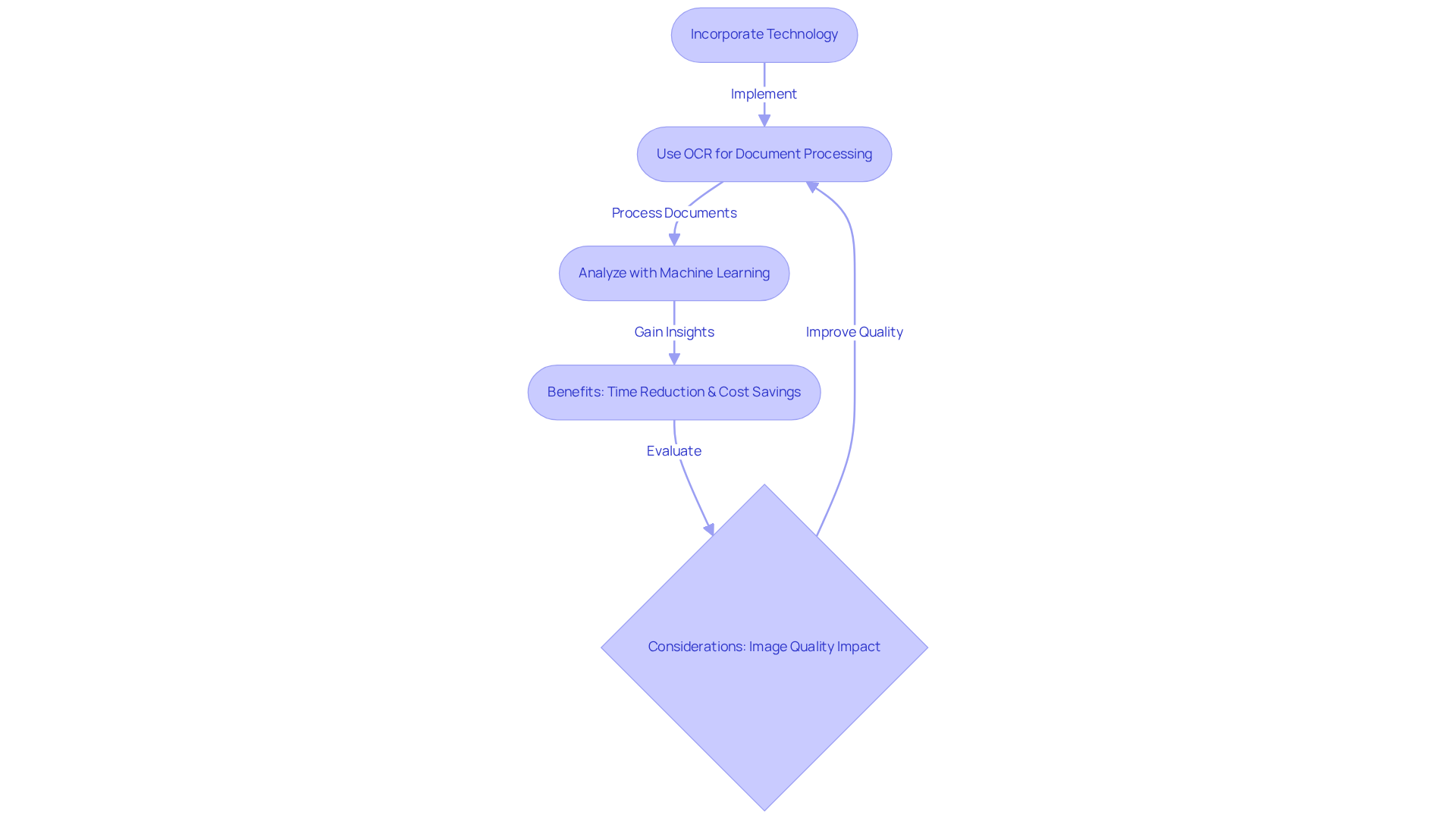
Incorporating tools into document research processes significantly enhances workflow effectiveness and precision. Optical character recognition (OCR) plays a crucial role by swiftly extracting essential information from extensive sets of document names, thereby greatly reducing the time spent on manual entry. For instance, financial organizations that have adopted OCR solutions report a 30% decrease in document processing time, as stated by Forbes, underscoring the system's capability to enhance operations. Furthermore, machine learning algorithms can analyze historical title information to identify patterns and anticipate potential issues, enabling title researchers to make informed decisions promptly.
The advantages of embracing these innovations extend beyond mere efficiency; they also lead to , with some organizations indicating a 25% decline in data entry mistakes. A statement from a legal expert reinforces this point, highlighting that 'OCR methods have aided in cutting document search duration by half.' This further illustrates the beneficial influence of these advancements. However, it is essential to consider potential pitfalls, such as the impact of low-quality images on OCR accuracy, which can hinder the effectiveness of these tools.
Parse AI exemplifies this transformation, demonstrating how advanced technologies can facilitate faster and more accurate property ownership verification, ultimately enhancing the overall title research experience.

Conclusion
Land grid systems and title overlays are foundational elements in title research, providing a structured approach to managing property data. Implementing these systems significantly enhances researchers' ability to track ownership, resolve disputes, and ensure compliance with zoning regulations. Furthermore, the integration of technologies like Geographic Information Systems (GIS) amplifies the effectiveness of these frameworks, allowing for a more comprehensive analysis of land-related information.
Throughout this article, key insights illustrate how the application of title overlays and advanced technology can address common challenges in title research. Systematic approaches, collaboration with professionals, and the use of machine learning and OCR tools streamline workflows and improve accuracy. Consequently, these strategies not only mitigate risks associated with incomplete records and discrepancies but also facilitate more informed decision-making in real estate transactions.
Ultimately, embracing land grid systems and title overlays is essential for anyone involved in title research. By leveraging these tools and technologies, researchers can navigate the complexities of property ownership with greater confidence and efficiency. The significance of these methodologies cannot be overstated; they empower professionals to deliver precise results in an increasingly intricate landscape, ultimately benefiting the entire real estate community.
Frequently Asked Questions
What are land grid systems?
Land grid systems are structured frameworks that divide land into parcels based on specific measurements, allowing for organized tracking of land ownership and related information.
What is the Public Land Survey System (PLSS)?
The Public Land Survey System (PLSS) is a type of land grid system that uses title overlays to simplify the identification of land parcels and facilitate ownership research.
Why are land grid systems important in title research?
They provide unique identifiers for each parcel, which helps in tracking ownership, access rights, and zoning regulations, making it essential for ownership researchers.
How do land grid systems enhance the efficiency of property researchers?
By simplifying the identification of land parcels, land grid systems allow property researchers to verify ownership more easily and resolve disputes, leading to more informed decision-making in real estate transactions.


