Overview
To obtain land use data for a parcel, stakeholders must utilize tools such as Geographic Information System (GIS) software, online information portals, and government resources. These instruments are essential for gathering comprehensive usage information that is vital for informed decision-making. Furthermore, these tools facilitate mapping, analysis, and compliance with regulations. Consequently, they ensure effective urban planning and resource management, ultimately reinforcing the reliability of the solutions offered.
Introduction
Understanding land use data is crucial for effective planning and decision-making across various sectors, from urban development to environmental conservation. This data not only informs stakeholders about how land is utilized—whether for residential, commercial, or agricultural purposes—but also enhances compliance with regulations and supports sustainable practices. However, acquiring accurate and comprehensive land use data often presents challenges.
How can individuals and organizations navigate these complexities to access the vital information they need for informed decision-making? This article outlines essential steps and tools for obtaining land use data for a parcel, ensuring that stakeholders are equipped to tackle these challenges head-on.
Understand Land Use Data and Its Importance
encompasses critical details on how terrain is employed across various categories, including residential, commercial, agricultural, and industrial applications. Its significance is underscored by several key factors:
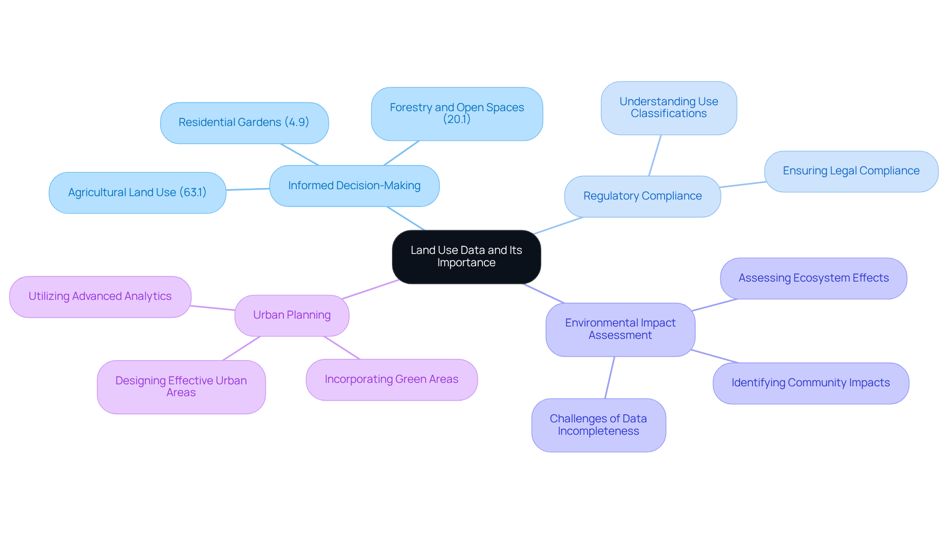
- : empowers stakeholders to make strategic decisions regarding zoning, development, and resource allocation. For instance, in 2022, 63.1% of usage in England, while forestry, open spaces, and residential gardens accounted for 20.1% and 4.9%, respectively. This highlights the necessity for and emphasizes the diverse applications of terrain.
- : Adhering to use regulations is essential for legal compliance across jurisdictions. Understanding assists in ensuring that developments conform to local regulations.
- : Examining usage information is crucial for assessing the of proposed developments. This analysis supports sustainable practices by identifying potential impacts on ecosystems and communities. However, stakeholders must also consider challenges such as information incompleteness, which can hinder analysis and limit insights.
- : City planners rely on usage information to design effective urban areas that meet community needs. Current trends indicate an increasing focus on incorporating green areas and sustainable methods into urban development, driven by extensive usage statistics. As of 2025, there is a growing emphasis on employing sophisticated analytics and visualization methods to enhance urban planning initiatives.
By acknowledging the significance of terrain usage information, stakeholders can efficiently understand how to get land use data for a parcel and apply this knowledge, ultimately resulting in more informed and impactful decision-making.

Gather Necessary Tools and Resources for Data Collection
To efficiently collect terrain , understanding how to get is crucial. The following key components are essential:
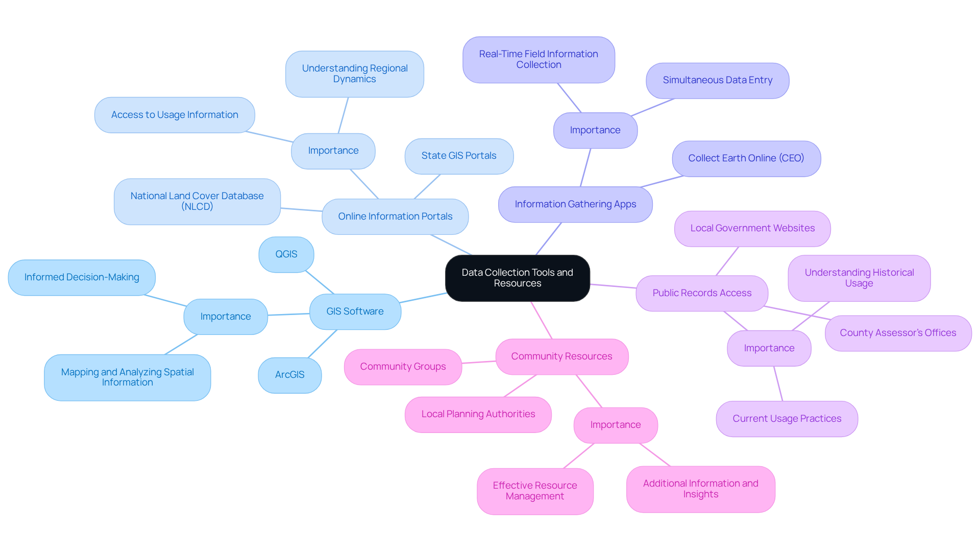
- : Leading tools such as ArcGIS and QGIS are indispensable for mapping and analyzing spatial information. Since the 1960s, has been utilized in planning practices, enabling users to visualize usage patterns and conduct detailed spatial analyses—critical for informed decision-making.
- Online Information Portals: Accessing platforms like the National Land Cover Database (NLCD) and various state GIS portals provides a wealth of usage information, which is vital for understanding regional usage dynamics.
- Information Gathering Apps: Mobile applications, particularly , facilitate real-time field information collection. This free, open-source tool, developed collaboratively by NASA, FAO, US Forest Service, and Google, allows users to efficiently collect and examine usage information while enabling concurrent data entry without requiring desktop installation. A case study from a CEO workshop in Myanmar exemplifies its practical application in monitoring efforts.
- : Familiarity with local government websites is essential, as these often contain usage records maintained by county assessor’s offices or planning departments. Accessing these records is crucial for understanding how to get , which sheds light on historical and current usage practices.
- Community Resources: Collaborating with local planning authorities and community groups can yield additional information and insights, enhancing the understanding of usage in specific regions. These interactions provide valuable context and support effective resource management decisions.
By gathering these tools and resources, one will be well-prepared to collect and analyze usage information effectively, leading to more informed and sustainable management decisions.

Access Land Use Data Through Official Channels
Understanding how to get is essential for obtaining in informed decision-making for real estate and property management. Here’s how to efficiently acquire this information:
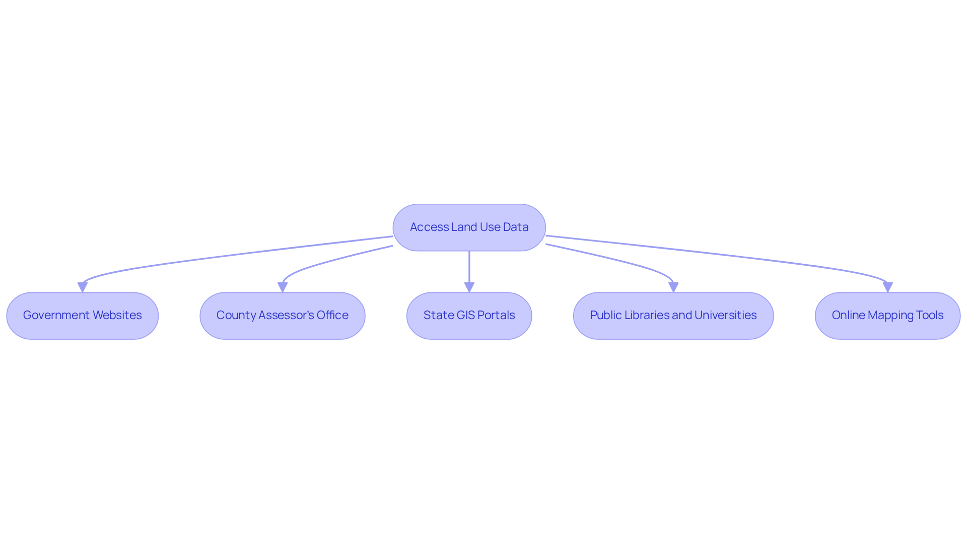
- Government Websites: Start by exploring local, state, and federal government websites. The offers the National Cover Database, providing extensive coverage information crucial for understanding usage trends nationwide. As Jon Dewitz, NLCD coordinator at USGS EROS, states, "Land cover has moved from a niche product to one being used every day in people’s lives."
- County Assessor’s Office: Most counties maintain comprehensive property use information through their assessor’s office. This data typically includes zoning classifications, property assessments, and usage statistics, which are vital for evaluating property potential and understanding how to get for a parcel. Given that property prices in the United States increased by an average of 7.96 percent annually from 2012 to 2022, obtaining precise usage information is more critical than ever.
- State GIS Portals: Numerous states feature Geographic Information System (GIS) portals that compile usage information from various agencies. For instance, the New Jersey Geographic Information Network provides parcel details that adhere to state standards, facilitating easier access to relevant information.
- Public Libraries and Universities: These institutions often subscribe to specialized databases and can assist in navigating usage information. They may also offer access to regional studies and reports that deepen the understanding of usage dynamics.
- Online Mapping Tools: Leverage platforms like Regrid, which deliver comprehensive parcel information and mapping features. These tools empower users to visualize terrain use patterns and make data-informed decisions based on geographic insights.
By utilizing these channels, you can effectively discover how to get land use data for a parcel, which is essential for your projects and analyses. Furthermore, the recent launch of a change dataset for North America’s three largest nations aims to aid GIS researchers in examining continent-wide usage alterations, further underscoring the importance of acquiring thorough usage information.

Troubleshoot Common Issues in Data Retrieval
When retrieving , you may encounter several common issues that require troubleshooting. Understanding these challenges is crucial for effective .
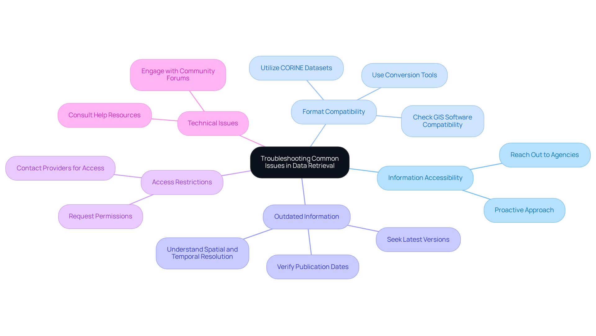
- Information Accessibility: If the information you require is not available online, it is imperative to reach out directly to the appropriate agency. They may possess unreleased information or can guide you on how to access it. It is noteworthy that individuals spend 60% to 80% of their time attempting to locate information; thus, being proactive is essential.
- Format Compatibility: Ensure that the formats you are working with align with your GIS software. If compatibility issues arise, consider utilizing conversion tools or services. Resources such as the can provide valuable datasets that may fulfill your requirements.
- Outdated Information: Always verify the publication date of the information you are using. If it is outdated, seek the latest version or inquire about updates from the information provider. Understanding the of the information is vital for precise analysis.
- : Some information may necessitate permissions or subscriptions. If you encounter access limitations, do not hesitate to contact the provider for assistance or to request access.
- Technical Issues: Should you experience technical difficulties with GIS software, consult the software’s help resources or community forums for troubleshooting tips. Engaging with these communities can often lead to swift solutions.
By preparing for these typical issues and leveraging available resources, you can significantly enhance your and learn how to get land use data for a parcel necessary for your analysis. As Veda Bawo, director of data governance, aptly stated, "You can have all of the fancy tools, but if [your] is not good, you're nowhere.

Conclusion
Understanding how to effectively gather and utilize land use data is essential for making informed decisions across various sectors, from urban planning to environmental assessments. This article has detailed the importance of land use data, emphasizing its critical role in informed decision-making, regulatory compliance, and sustainable urban planning. By leveraging the right tools and resources, stakeholders can significantly enhance their understanding of land usage patterns and their implications.
Key insights discussed include the necessity of Geographic Information System (GIS) software, online information portals, and community resources for effective data collection. Furthermore, the article outlined practical steps for accessing land use data through official channels, such as government websites and local assessor’s offices. Troubleshooting common issues in data retrieval—such as accessibility and format compatibility—further ensures that users can navigate potential obstacles in their research.
In conclusion, the significance of land use data cannot be overstated. It serves as a cornerstone for sustainable development and effective resource management. By embracing the tools and strategies outlined, stakeholders can contribute to more informed decision-making processes that benefit communities and the environment alike. Engaging with local planning authorities and utilizing available resources will foster a deeper understanding of land use dynamics, ultimately leading to better outcomes for all involved.
Frequently Asked Questions
What is land use data and why is it important?
Land use data includes critical details on how land is utilized across various categories such as residential, commercial, agricultural, and industrial applications. Its importance lies in informed decision-making, regulatory compliance, environmental impact assessment, and urban planning.
How does land use data aid in informed decision-making?
Land use data empowers stakeholders to make strategic decisions regarding zoning, development, and resource allocation. For example, in 2022, agricultural territory represented 63.1% of land use in England, highlighting the need for data-driven planning.
Why is regulatory compliance important in land use?
Regulatory compliance is essential for ensuring that developments adhere to local regulations. Understanding specific land use classifications helps stakeholders ensure that their projects conform to legal requirements.
How does land use data contribute to environmental impact assessments?
Analyzing land use data is crucial for assessing the environmental effects of proposed developments. This analysis helps identify potential impacts on ecosystems and communities, supporting sustainable practices.
What role does land use data play in urban planning?
City planners use land use data to design urban areas that meet community needs. There is a growing focus on incorporating green areas and sustainable methods into urban development, driven by extensive usage statistics.
What challenges are associated with land use data?
One challenge is the incompleteness of information, which can hinder analysis and limit insights regarding land use and its impacts.
How can stakeholders effectively use land use data?
By acknowledging the significance of land use data, stakeholders can understand how to obtain this information for a specific parcel and apply it to make informed and impactful decisions.


