Overview
This article provides a comprehensive comparison of various platforms designed for filtering properties by land use, underscoring their distinctive features, advantages, and disadvantages. The significance of accurate title research is paramount, as the choice of platform is contingent upon specific user needs, including budget constraints and required functionalities.
For instance, different platforms cater to diverse professional requirements in real estate and title research, illustrating their unique capabilities. Furthermore, understanding these differences enables users to make informed decisions that align with their operational demands.
In addition, the article highlights how each platform addresses the challenges faced by professionals in the field, ultimately guiding users toward optimal solutions that enhance their efficiency and effectiveness.
Introduction
In the dynamic world of real estate, the ability to efficiently filter properties by land use is paramount for professionals navigating complex urban landscapes. These specialized platforms categorize properties based on their designated purposes—residential, commercial, agricultural, or industrial—and integrate advanced technologies like Geographic Information Systems (GIS) and satellite imagery to provide critical insights.
However, with numerous options available, determining which platform truly enhances decision-making and meets specific needs becomes a challenge. This article delves into a comparative analysis of leading land use filtering platforms, exploring their unique features, benefits, and potential drawbacks, guiding users in making informed choices.
Understanding Land Use Filtering Platforms
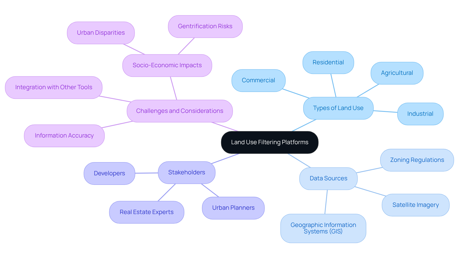
Platforms for filtering properties by land use are specialized tools meticulously designed to categorize and analyze areas based on their designated purpose—be it residential, commercial, agricultural, or industrial. These platforms leverage multiple information sources, including Geographic Information Systems (GIS), satellite imagery, and local zoning regulations, to provide individuals with critical insights into availability, suitability, and potential development opportunities. These platforms for filtering properties by land use empower real estate experts, urban planners, and developers to make informed decisions regarding property acquisition and development by filtering properties according to specific use criteria.
The effectiveness of platforms for filtering properties by land use hinges on their information accuracy, user interface, and ability to integrate with other real estate tools, rendering them essential in the contemporary real estate landscape. Accurate information is paramount, as evidenced by socio-economic evaluations highlighting emerging threats of gentrification and disparity in urban regions like Shimla, where urbanization has led to significant changes in land use and cover. Furthermore, the integration of GIS technology enhances usage analysis by providing detailed spatial data that informs decision-making processes. For instance, satellite imagery can reveal changes in land cover over time, allowing users to assess urban growth or environmental impacts effectively.
In addition, various techniques are employed to generate usage and coverage estimates, with usage typically gauged through surveys and coverage assessed via remote sensing. Specific classifications, such as wetlands and riparian zones, are vital for comprehensive usage analysis. As the demand for efficient and precise territory use analysis escalates, the role of GIS technology continues to evolve, offering innovative solutions that enhance the effectiveness of platforms for filtering properties by land use.

Key Features of Leading Platforms
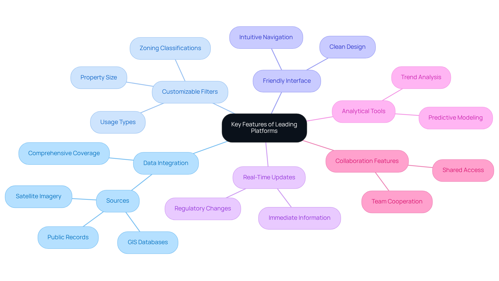
Prominent platforms for filtering properties by land use offer a variety of features aimed at enhancing user experience and improving information accessibility. These key features include:
- Data Integration: This capability allows users to pull data from diverse sources such as public records, GIS databases, and satellite imagery, ensuring comprehensive coverage of land use information.
- Customizable Filters: Users can apply specific filters based on criteria like zoning classifications, property size, and usage types on platforms for filtering properties by land use, which facilitates tailored searches that meet individual needs.
- Friendly Interface: A clean and intuitive interface simplifies navigation and enhances user engagement, making it easier to access desired information.
- Real-Time Updates: Platforms that provide immediate information updates ensure individuals have access to the latest details regarding property use alterations and regulations, which is crucial for informed decision-making.
- Analytical Tools: Advanced analytical capabilities, including predictive modeling and trend analysis, empower users to forecast usage changes and assess potential impacts on property values.
- Collaboration Features: These tools foster cooperation among team members by allowing shared access to information and insights, which is essential for effective project management in real estate development.

Pros and Cons of Each Solution
When evaluating land use filtering platforms, it is crucial to analyze the advantages and disadvantages of each option:
-
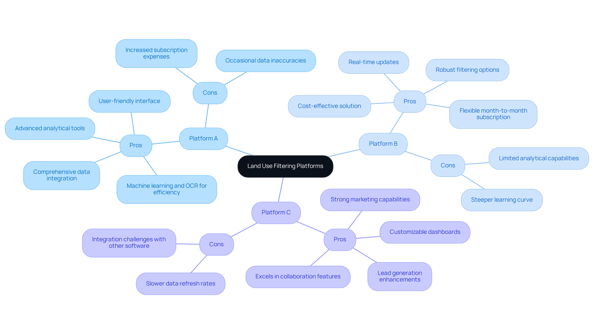
Platform A:
- Pros: Offers comprehensive data integration, a user-friendly interface, and advanced analytical tools that enhance decision-making capabilities. Notably, Parse AI utilizes machine learning and optical character recognition to extract information from title documents, significantly improving efficiency for real estate professionals.
- Cons: Involves increased subscription expenses, and individuals may encounter occasional data inaccuracies stemming from reliance on third-party sources.
-
Platform B:
- Pros: Provides a cost-effective solution with robust filtering options and real-time updates, making it suitable for budget-conscious users. For example, Actovia's pricing ranges from $319 to $389 per individual each month, offering a flexible month-to-month subscription model.
- Cons: Features limited analytical capabilities and presents a steeper learning curve for newcomers, which may hinder immediate productivity.
-
Platform C:
- Pros: Excels in collaboration features and offers customizable dashboards, allowing teams to tailor their experience to specific project needs. Crexi, for instance, boasts strong marketing capabilities and lead generation, which can enhance engagement.
- Cons: Experiences slower data refresh rates and may face integration challenges with other software, potentially impacting workflow efficiency.
By carefully weighing these pros and cons, individuals can effectively determine which operational workflows and specific requirements can be met by platforms for filtering properties by land use. Incorporating input from users and case studies, such as the results of using Parse AI, can further inform this decision-making process.

Suitability for Title Research Professionals
The suitability of platforms for filtering properties by land use for title research professionals varies significantly based on their specific functionalities and user experience.
-
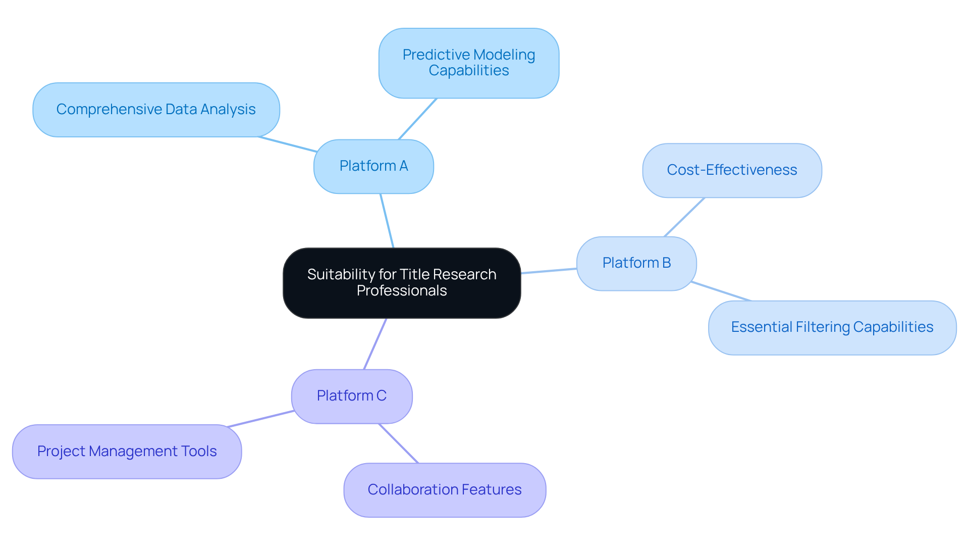
Platform A stands out as the optimal choice for professionals requiring comprehensive data analysis and predictive modeling capabilities. Its robust features not only support in-depth research but also enhance decision-making processes, aligning seamlessly with the technological advancements in GIS technology that bolster predictive modeling.
-
Platform B is particularly well-suited for budget-conscious professionals who seek essential filtering capabilities without the necessity for advanced analytics. Its cost-effectiveness renders it especially appealing to smaller firms aiming to maximize their resources, a sentiment echoed in external sources discussing the growing demand for affordable solutions in the market.
-
Platform C is recommended for teams that prioritize collaboration and project management. Its features facilitate teamwork and data sharing, which are crucial for larger title research projects.
Ultimately, the choice of platforms for filtering properties by land use depends on the specific needs of the title research professional, including budget constraints, required features, and project complexity. As the land management software market is projected to grow at a CAGR of 5.65% from 2024 to 2031, the demand for effective filtering solutions is poised to increase. This trend underscores the critical importance of selecting the right tools to enhance efficiency and accuracy in title research. Furthermore, platforms like Parse AI illustrate how integrating AI and machine learning can yield significant cost savings and improve workflow efficiency, further emphasizing the relevance of these technologies in the current market landscape.

Conclusion
Platforms designed for filtering properties by land use are indispensable in the real estate landscape, enabling users to make informed decisions grounded in accurate and comprehensive data. By leveraging advanced technologies such as GIS and satellite imagery, these platforms empower real estate professionals, urban planners, and developers to analyze land use effectively, ensuring that property acquisitions and developments align with specific criteria.
Key features of leading platforms include:
- Data integration
- Customizable filters
- User-friendly interfaces
- Real-time updates
- Advanced analytical tools
Each platform presents distinct advantages and disadvantages, catering to a diverse array of user needs—from comprehensive data analysis to budget-friendly solutions and collaborative features. The suitability of these platforms for title research professionals underscores the necessity of selecting the right tool based on specific project requirements, budget constraints, and desired functionalities.
As the demand for effective land use filtering solutions grows, it becomes increasingly vital for professionals in the field to stay informed about the latest technologies and platforms available. Embracing these tools not only enhances efficiency and accuracy in title research but also equips users to navigate the complexities of the real estate market adeptly. Ultimately, the right platform can significantly impact decision-making processes, making it essential to evaluate options carefully and choose the one that best meets individual and organizational needs.
Frequently Asked Questions
What are land use filtering platforms?
Land use filtering platforms are specialized tools designed to categorize and analyze areas based on their designated purpose, such as residential, commercial, agricultural, or industrial uses.
What information sources do these platforms utilize?
These platforms leverage multiple information sources, including Geographic Information Systems (GIS), satellite imagery, and local zoning regulations.
Who benefits from using land use filtering platforms?
Real estate experts, urban planners, and developers benefit from these platforms as they help make informed decisions regarding property acquisition and development.
What factors contribute to the effectiveness of land use filtering platforms?
The effectiveness of these platforms hinges on information accuracy, user interface quality, and the ability to integrate with other real estate tools.
Why is accurate information important in land use filtering?
Accurate information is crucial as it informs socio-economic evaluations and helps address emerging threats such as gentrification and disparity in urban areas.
How does GIS technology enhance land use analysis?
GIS technology enhances usage analysis by providing detailed spatial data that informs decision-making processes, allowing users to assess urban growth or environmental impacts effectively.
What techniques are used to generate usage and coverage estimates?
Usage is typically gauged through surveys, while coverage is assessed via remote sensing. Specific classifications, such as wetlands and riparian zones, are also vital for comprehensive analysis.
How is the role of GIS technology evolving in land use analysis?
As the demand for efficient territory use analysis increases, the role of GIS technology continues to evolve, offering innovative solutions that enhance the effectiveness of land use filtering platforms.


