Overview
The article emphasizes the eight essential types of land records in the U.S. that title researchers require for effective property verification and ownership confirmation. It underscores the critical role of federal documents, including:
- Patents
- Deeds
- Surveys
Furthermore, it discusses advanced tools such as Parse AI, which streamline the research process and significantly enhance the accuracy of confirming property ownership.
Introduction
The intricate world of land records in the United States serves as the backbone of property ownership and title research. Yet, many remain unaware of the diverse types that exist. Understanding these records is not merely a legal formality; it is essential for ensuring accurate property verification and navigating complex ownership claims. As researchers delve into the nuances of federal documents, historical archives, and advanced technological tools, they may grapple with a critical question: How can one effectively leverage these resources to streamline the title research process and mitigate potential disputes?
Parse AI: Advanced Machine Learning for Title Research Automation
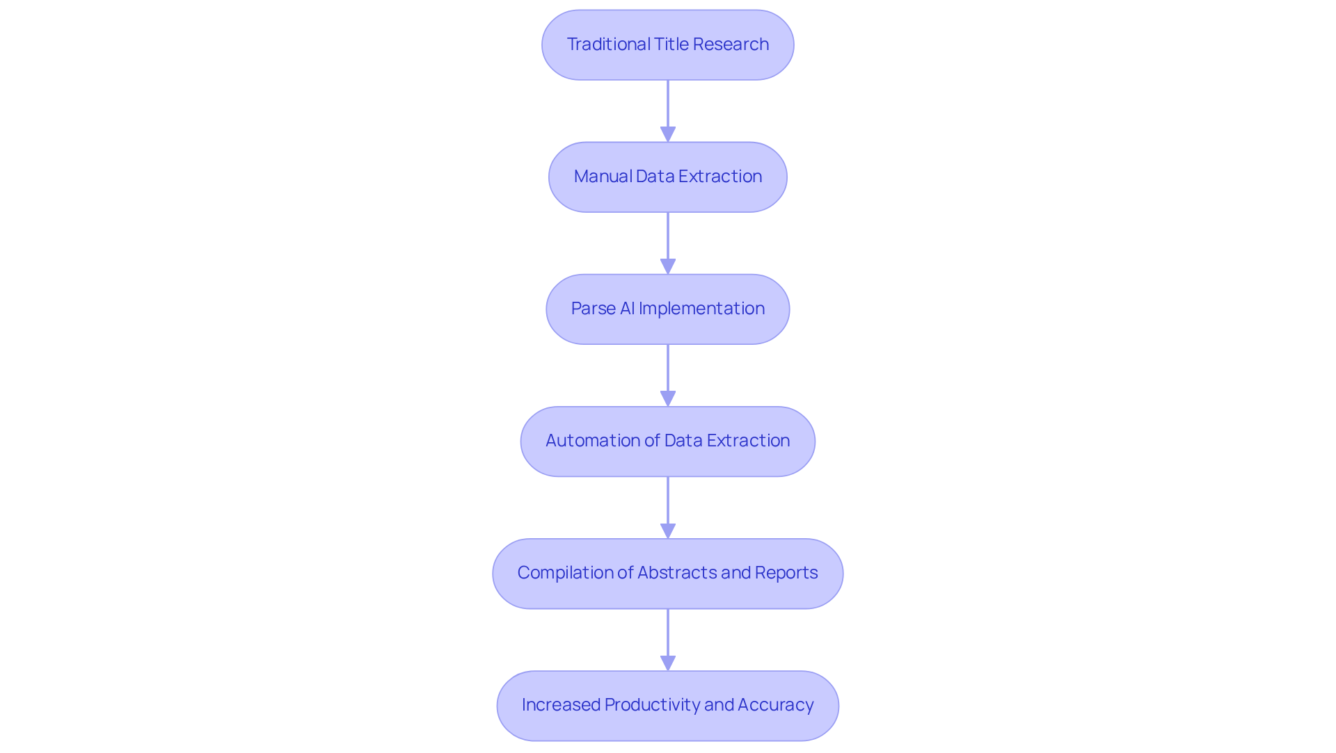
Parse AI leverages advanced machine learning algorithms and optical character recognition (OCR) to automate the extraction of vital information from extensive document collections. This cutting-edge technology empowers researchers to swiftly and accurately compile abstracts and reports, significantly boosting their productivity. By automating repetitive tasks, Parse AI allows professionals to concentrate on the more intricate aspects of title research. Consequently, this leads to faster and more reliable property ownership confirmations.
Federal Land Records: Key Documents for Property Verification
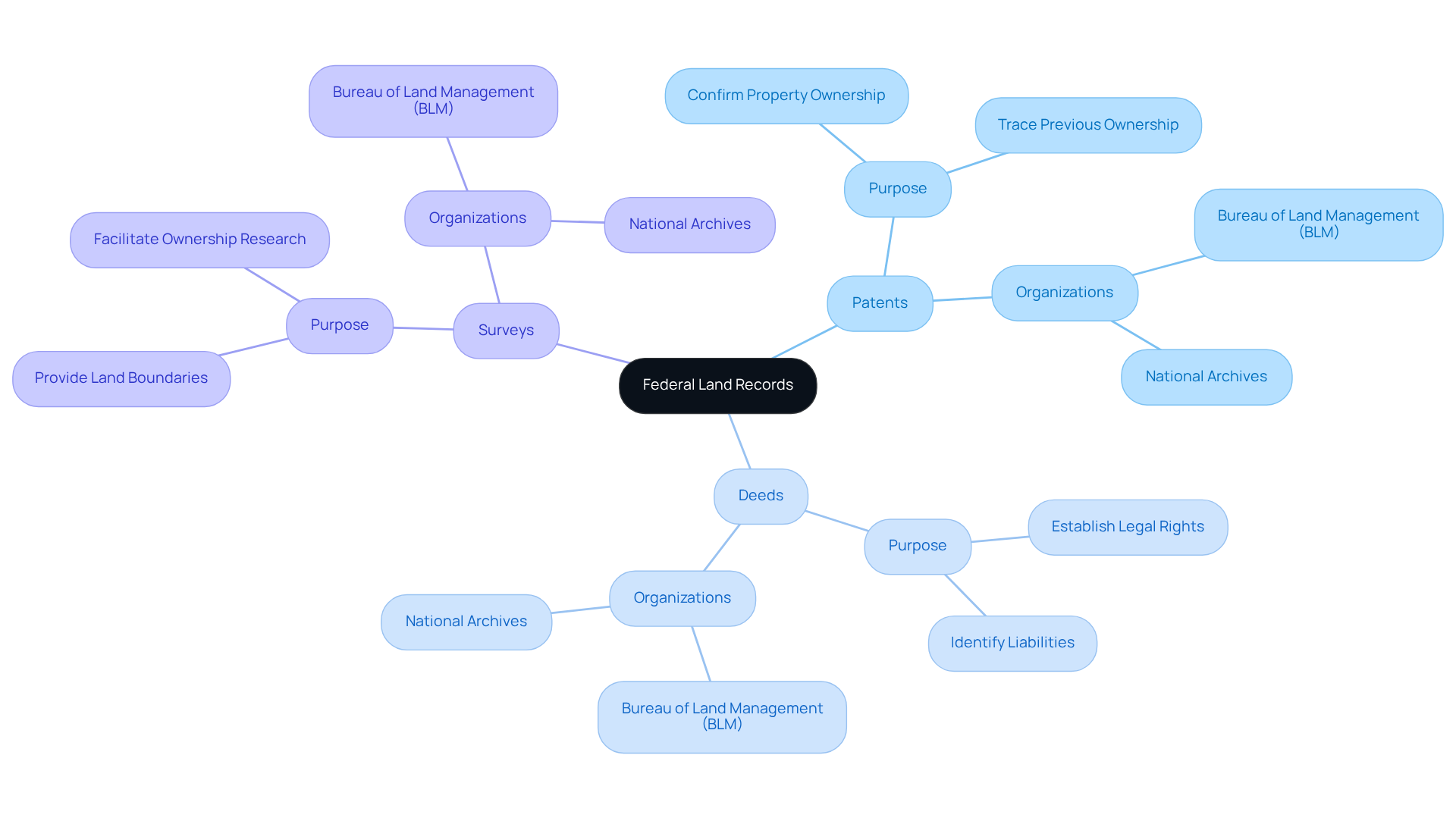
Federal land documentation consists of important types of land records in the US, including patents, deeds, and surveys, which are crucial for confirming property ownership. These documents are systematically preserved by governmental organizations, particularly the Bureau of Land Management (BLM) and the National Archives. Title specialists utilize the types of land records in the US to ascertain the legal condition of properties, trace previous ownership, and identify any liabilities that may impact ownership rights.
In 2025, the importance of various types of land records in the US is underscored by the BLM General Land Office Archives, which provides online access to over five million federal property ownership documents issued since 1820. This extensive database features survey plats and field notes dating back to 1810, offering researchers a rich repository of historical and current information. Furthermore, the Mineral & Land Records System (MLRS) integrates several legacy BLM systems, enhancing the efficiency of managing mineral and property transaction data.
For instance, the Alaska Spatial Data Management System (SDMS) allows users to view, investigate, print, and download information on surveyed property parcels and mining claims, thereby facilitating ownership research efforts. By leveraging these federal documents and employing advanced machine learning tools from Parse AI, property investigators can streamline their processes, effectively verify ownership, and navigate the complexities of property transactions with improved precision and speed.
General Land Office Records: Essential Historical Land Data
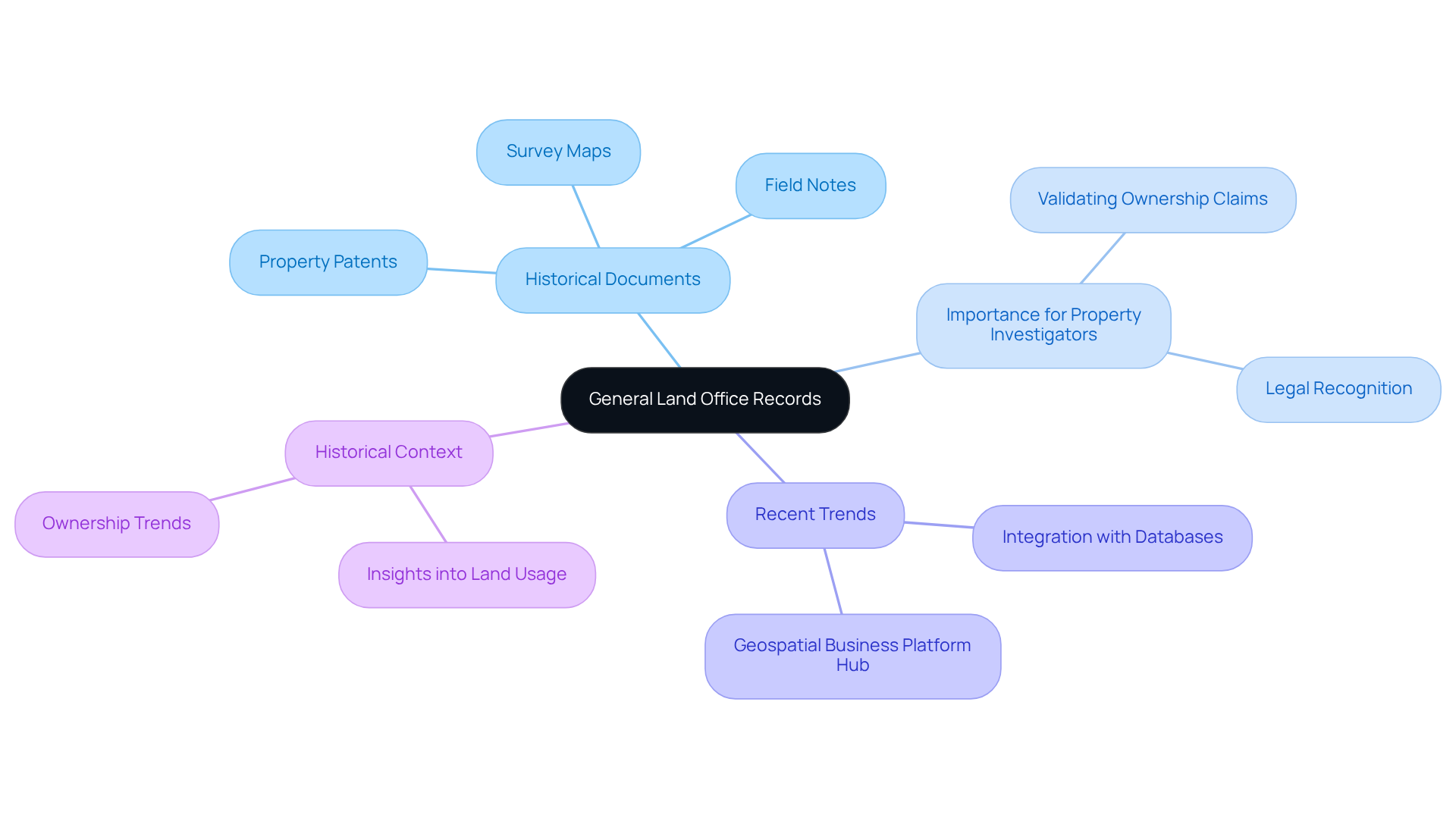
General Land Office (GLO) documents represent a significant repository of historical information, encompassing over five million federal property ownership documents, including property patents, survey maps, and field notes dating back to 1820. These documents are indispensable for property investigators, as they offer comprehensive insights into the types of land records in the US, including original land grants and subsequent ownership transfers. By meticulously examining GLO documentation, experts can construct a detailed property history, which is crucial for validating ownership claims and ensuring legal recognition of various types of land records in the US.
Recent trends indicate a growing reliance on the types of land records in the US among researchers, particularly as numerous systems and databases begin to integrate with GLO archives. The Bureau of Land Management's Geospatial Business Platform Hub, introduced in 2022, consolidates multiple geospatial data systems, enhancing access to various types of land records in the US and underscoring their importance in ownership research.
Case studies, such as the analysis of Austin's Colony Records, illustrate how the types of land records in the US can inform contemporary ownership research practices. These documents not only detail property titles and agreements but also represent the types of land records in the US, shaping perceptions of early property ownership in Texas.
Historians underscore the importance of historical land data, with one stating, "A people without the knowledge of their past history, origin and culture is like a tree without roots." Another historian asserts, "If you don’t know history, then you don’t know anything," highlighting the necessity of utilizing GLO documents to connect current ownership with historical context. This ensures that property investigators are equipped with the knowledge required to navigate complex ownership claims effectively.
As of 2025, discoveries from GLO documentation continue to reveal essential information regarding the types of land records in the US, including insights into usage and ownership trends, reinforcing their role as an indispensable resource for those committed to upholding the integrity of property transactions.
Alaska Spatial Data Management System: Unique Resources for Title Research
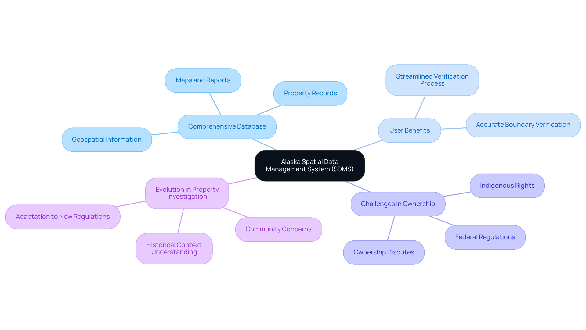
The Alaska Spatial Data Management System (SDMS) serves as an essential resource for property analysts, offering a comprehensive database of property records that encompasses maps, reports, and geospatial information. This system is particularly advantageous in tackling the intricate property ownership issues prevalent in Alaska, where factors such as indigenous rights and federal regulations complicate ownership claims. By leveraging SDMS, scientists can accurately identify and verify property boundaries, a critical component for precise ownership assessments. As one geographic service expert noted, the ability to access extensive geospatial data significantly streamlines the verification process, facilitating quicker resolutions to ownership disputes.
In 2025, the landscape of property investigation continues to evolve, necessitating that scholars adapt to new regulations and community concerns regarding land use. The SDMS not only aids in overcoming these challenges but also fosters a deeper understanding of the area's historical context. This ensures that those examining ownership can effectively navigate the complexities of Alaska's unique property landscape.
Mineral & Land Records System: Navigating Mineral Rights and Ownership
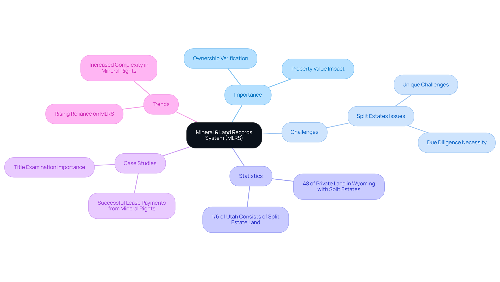
The Mineral & Land Records System (MLRS) is an essential resource for title researchers navigating properties with mineral rights. This system meticulously tracks ownership and transactions related to mineral resources, enabling precise confirmation of both property and mineral ownership. Given that mineral rights can substantially impact property value and usage, grasping their complexities is crucial. Notably, 48% of private land in Wyoming features split estates, underscoring the prevalence of mineral rights issues.
Experts in the industry assert that when surface and mineral rights are divided, unique challenges emerge, necessitating rigorous due diligence to safeguard investments. Current trends indicate a rising reliance on the MLRS for effective research, particularly in resource-rich areas where mineral rights can enhance property value.
Successful ownership research cases demonstrate how leveraging the MLRS can clarify disputes and streamline transactions; for example, a client received significant lease payments from leasing mineral rights for natural gas. By employing the MLRS, property specialists can confidently navigate the intricate landscape of mineral rights, ensuring informed decision-making and protecting their clients' interests.
Geospatial Business Platform Hub: Enhancing Property Boundary Analysis
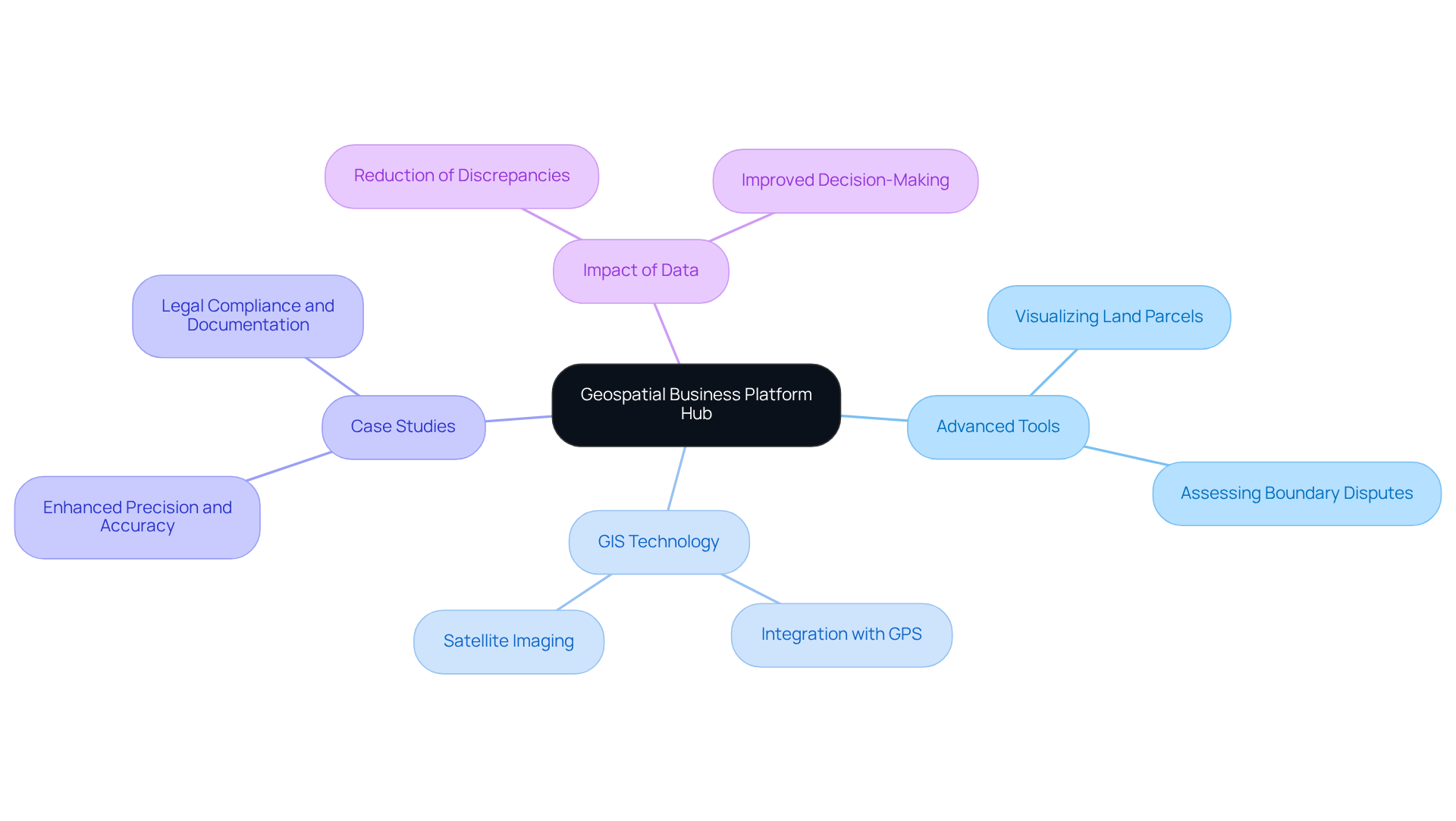
The Geospatial Business Platform Hub is a pivotal resource for property analysts, equipping them with advanced tools to examine property boundaries and significantly enhancing their workflow. By leveraging GIS technology, researchers can visualize land parcels with precision, effectively assess boundary disputes, and ensure compliance with zoning regulations. This advanced analytical capability not only facilitates informed decision-making but also minimizes the risk of errors in property assessments.
For instance, a case study titled 'Enhanced Precision and Accuracy in Property Boundary Applications' illustrates how these tools have resolved numerous boundary disputes, showcasing the technology's ability to provide accurate measurements and clear documentation. As Robert Rundstrum aptly states, 'Mapping is essential to the process of lending order to the world,' which underscores the transformative role of GIS in property research. Furthermore, the impact of geospatial data on ownership research accuracy is significant; studies indicate that GIS-driven analyses can reduce discrepancies in property evaluations by as much as 30%, as highlighted in recent market reports.
This integration of technologies such as GPS and satellite imaging further reinforces the capabilities of GIS, making it indispensable for professionals seeking to enhance accuracy and efficiency in their work.
Digitization of Historical Land Records: Streamlining Title Research
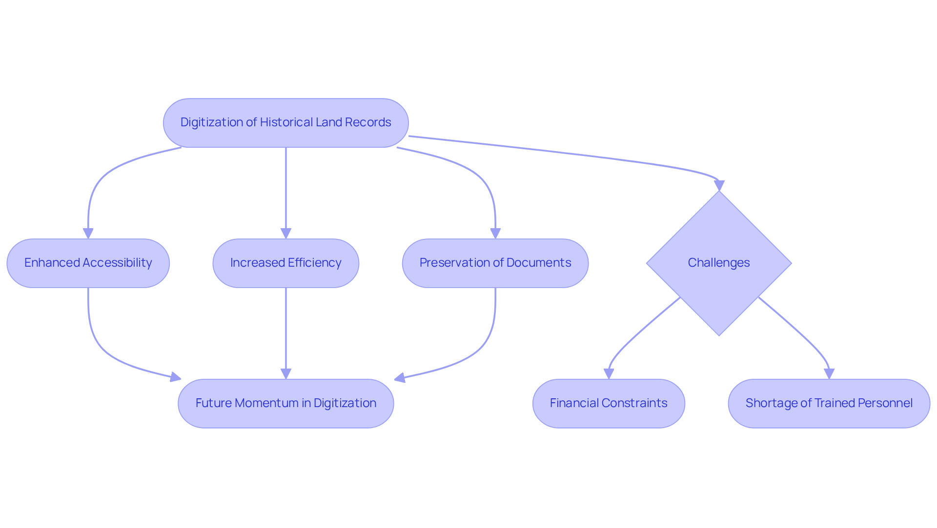
The digitization of historical property documents has fundamentally transformed title research, significantly enhancing both accessibility and searchability of these essential files. By converting tangible documents into digital formats, scholars can swiftly locate relevant information, dramatically reducing the time spent on manual searches. This transition not only boosts efficiency but also preserves historical documents for future generations, ensuring that vital information remains readily accessible.
Notably, regions such as Madhya Pradesh and Tamil Nadu have set benchmarks in digitization, ranking among the top five performing states in property digitization in 2021 under the Digital India Land Records Modernization Programme. Title researchers have noted that digital archives streamline their workflows, facilitating quicker access to essential data, which is crucial in a sector where the real estate market contributes 5-6% to the GDP.
As President Draupadi Murmu emphasized, the digitization of property will assist in curbing illegal activities associated with it, underscoring its importance. Nevertheless, challenges such as financial constraints and a shortage of trained personnel continue to hinder the digitization process. As the sector progressively embraces these innovations, the movement towards digitizing property documentation is expected to gain momentum, further enhancing the effectiveness of ownership research.
Inventorying Land Records: A Fundamental Step for Title Researchers
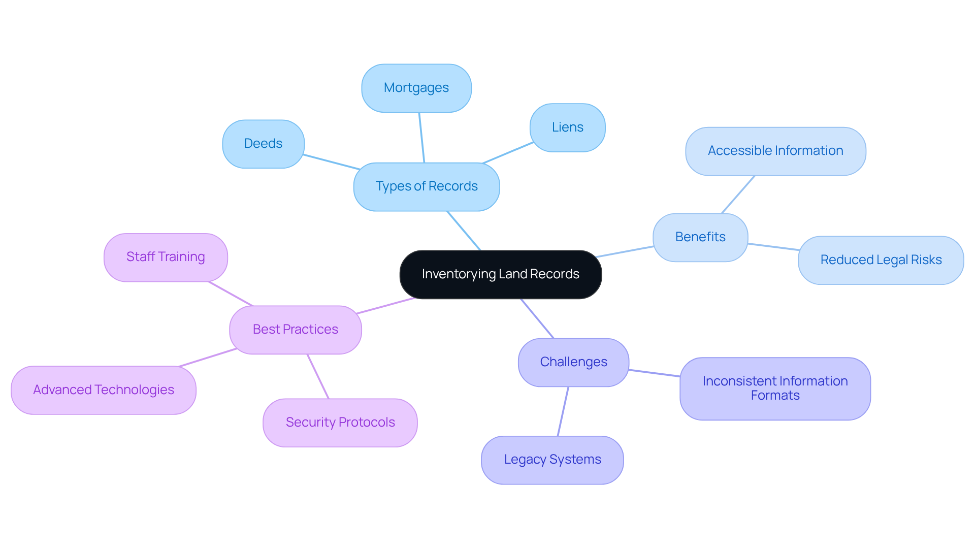
Efficiently organizing property ownership documents is essential for title researchers and includes various types of land records in the US, such as deeds, mortgages, and liens. This systematic inventorying process not only guarantees that all pertinent information is readily accessible but also plays a vital role in identifying potential issues like outstanding liens or ownership disputes. A well-organized inventory streamlines transactions, significantly reducing the risk of legal complications.
For instance, organizations that have adopted centralized databases have reported enhanced efficiency and improved collaboration across departments, demonstrating the value of systematic cataloging. Furthermore, industry leaders stress that maintaining precise property documents is crucial for equitable taxation and legal conflict resolution, underscoring the broader implications of efficient cataloging methods.
As of 2025, common challenges identified during property inventorying include inconsistent information formats and legacy systems, which complicate integration and lead to operational inefficiencies. To tackle these challenges, optimal methods for cataloging property documents involve:
- Consistent training for staff
- Utilizing advanced technologies such as Parse AI's example manager and document research automation features for processing
- Establishing strong security protocols to safeguard sensitive information
By prioritizing these strategies, title researchers can ensure a comprehensive and reliable approach to managing the types of land records in the US.
Conclusion
The diverse types of land records in the US play a crucial role in title research, serving as the backbone for property verification and ownership confirmation. Understanding these records is essential for title researchers as they navigate the complexities of property transactions, ensuring legal clarity in ownership claims.
Key arguments throughout the article highlight the significance of various land records, including:
- Federal land records
- General Land Office documents
- Specialized systems like the Alaska Spatial Data Management System
- The Mineral & Land Records System
Each of these resources offers unique insights and tools that facilitate accurate and efficient title research, empowering professionals to overcome challenges in property ownership verification. Furthermore, the integration of advanced technologies such as Parse AI and geospatial tools has transformed the landscape of title research, enhancing productivity and precision.
In light of these insights, it is imperative for title researchers to embrace the evolving landscape of land records and the technologies that support them. By leveraging these resources and adopting best practices for inventorying and digitization, professionals can streamline their workflows and uphold the integrity of property transactions. As the demand for reliable ownership verification continues to grow, staying informed about the latest developments in land records will be vital for success in this field.
Frequently Asked Questions
What is Parse AI and how does it assist in title research?
Parse AI is a technology that uses advanced machine learning algorithms and optical character recognition (OCR) to automate the extraction of important information from large document collections. It helps researchers quickly and accurately compile abstracts and reports, significantly enhancing productivity by allowing professionals to focus on more complex aspects of title research.
What types of documents are included in federal land records?
Federal land records include patents, deeds, and surveys, which are essential for confirming property ownership. These documents are maintained by governmental organizations such as the Bureau of Land Management (BLM) and the National Archives.
How do title specialists use land records?
Title specialists use land records to determine the legal status of properties, trace previous ownership, and identify any liabilities that may affect ownership rights.
What resources are available for accessing federal property ownership documents?
The BLM General Land Office Archives provides online access to over five million federal property ownership documents issued since 1820, including survey plats and field notes dating back to 1810. This extensive database serves as a valuable resource for researchers.
What is the Mineral & Land Records System (MLRS)?
The Mineral & Land Records System (MLRS) is a system that integrates several legacy BLM systems to enhance the management of mineral and property transaction data.
How does the Alaska Spatial Data Management System (SDMS) support property research?
The Alaska Spatial Data Management System (SDMS) allows users to view, investigate, print, and download information on surveyed property parcels and mining claims, thereby aiding ownership research efforts.
What benefits do Parse AI and federal documents provide to property investigators?
By utilizing federal documents and advanced machine learning tools from Parse AI, property investigators can streamline their processes, effectively verify ownership, and navigate the complexities of property transactions with greater accuracy and speed.


